

Tucked inside the dramatic sandstone of Red Rock Canyon, the Calico Tanks Trail packs a lot of reward into just over 2 miles. It starts off mellow, throws in a few fun scrambles, and—if conditions are right—ends with a hidden pool and a view of the Las Vegas Strip.
It’s one of the most popular hikes in the park, but for good reason: minimal effort, maximum payoff. And we’ll show you exactly when to go, what to expect, and how to find the best photo spots along the way.
Calico Tanks Hike At a Glance
| Trail Description | Out and back |
| Trail Start | Sandstone Quarry Parking Lot, Red Rock Canyon Scenic Loop |
| Round Trip Mileage | ~2.2 miles |
| Elevation Gain | ~390 feet |
| Highest Elevation | ~4,720 feet |
| Average Time | 1.5 – 2.0 hours (Total) |
| Difficulty | Moderate (light scrambling + stairs) |
| Fees | Entry fee or America the Beautiful Pass required. See current rates here. |
| Reservations | Yes, October 1 – May 31st (timed entry for scenic loop access) |
| Best Time to Go | Spring or after recent rain (for best chance to see water in tank) – watching footing if rock is wet. |
| Moose Rating | 4 out of 5 |
What it’s like to Hike Calico Tanks Trail
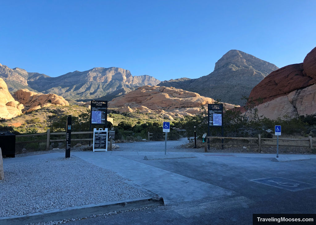
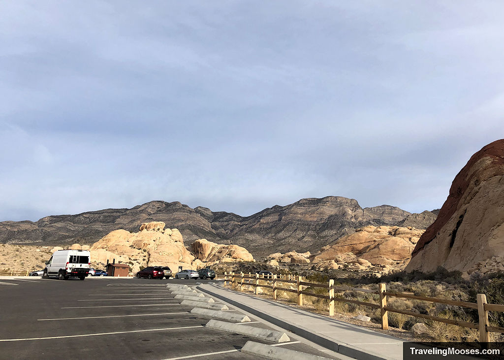
We started our hike from the Sandstone Quarry lot, one of the larger trailheads on the Red Rock Scenic Loop. There’s a restroom, trail map, and signage for both Calico Tanks and Turtlehead Peak.
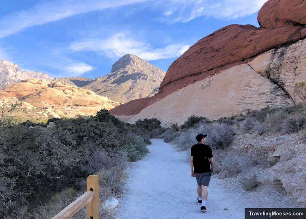
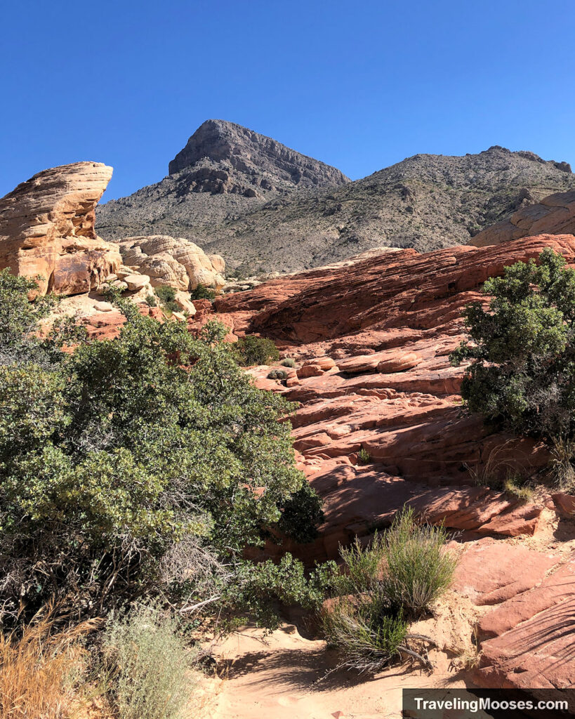
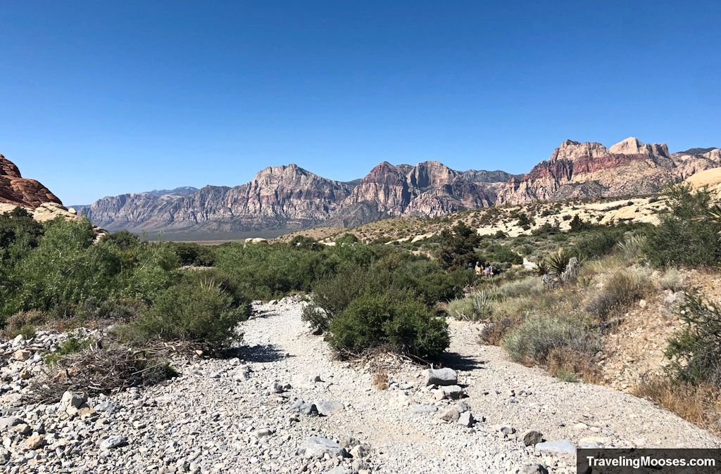
The trail begins easy—flat, sandy, and framed by bold red rock formations. Don’t be discouraged if the first stretch feels crowded; many visitors turn back before the real trail begins.
Stay Left Early On
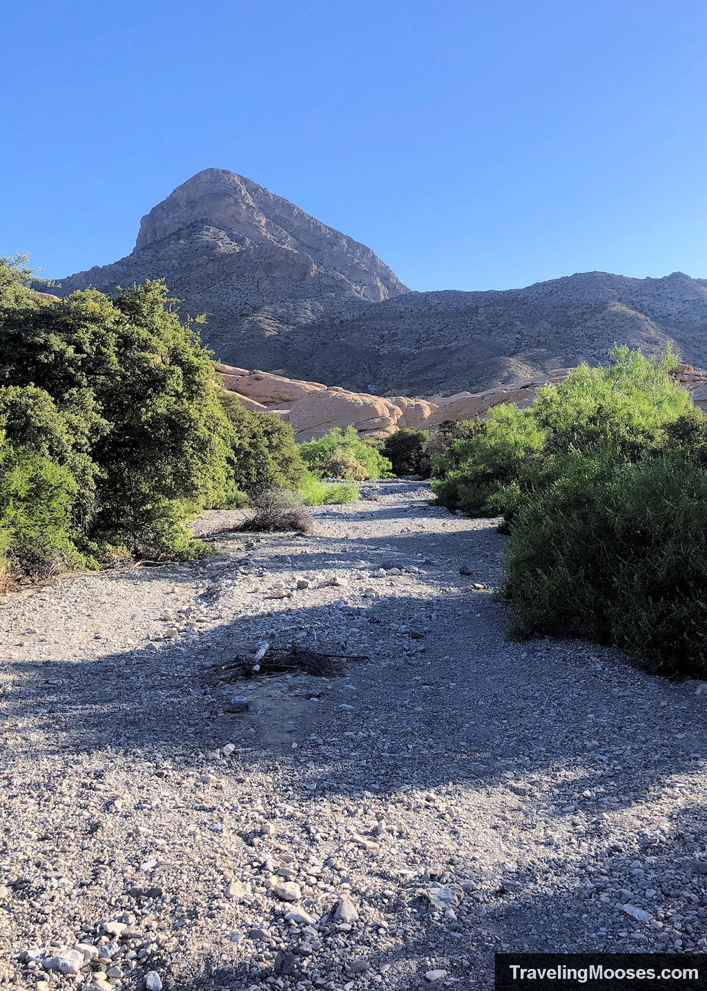
Just past the quarry, you’ll see a wide, rocky wash. It’s tempting to follow, but the true trail cuts just left and reconnects shortly after. Look for signs or watch where more experienced hikers are headed.
Shortly after, the Turtlehead Peak trail splits left, and you’ll stay right to continue toward Calico Tanks.
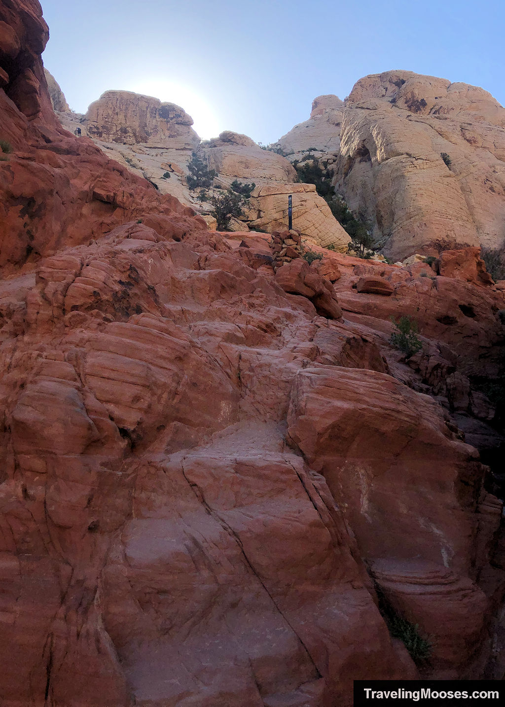
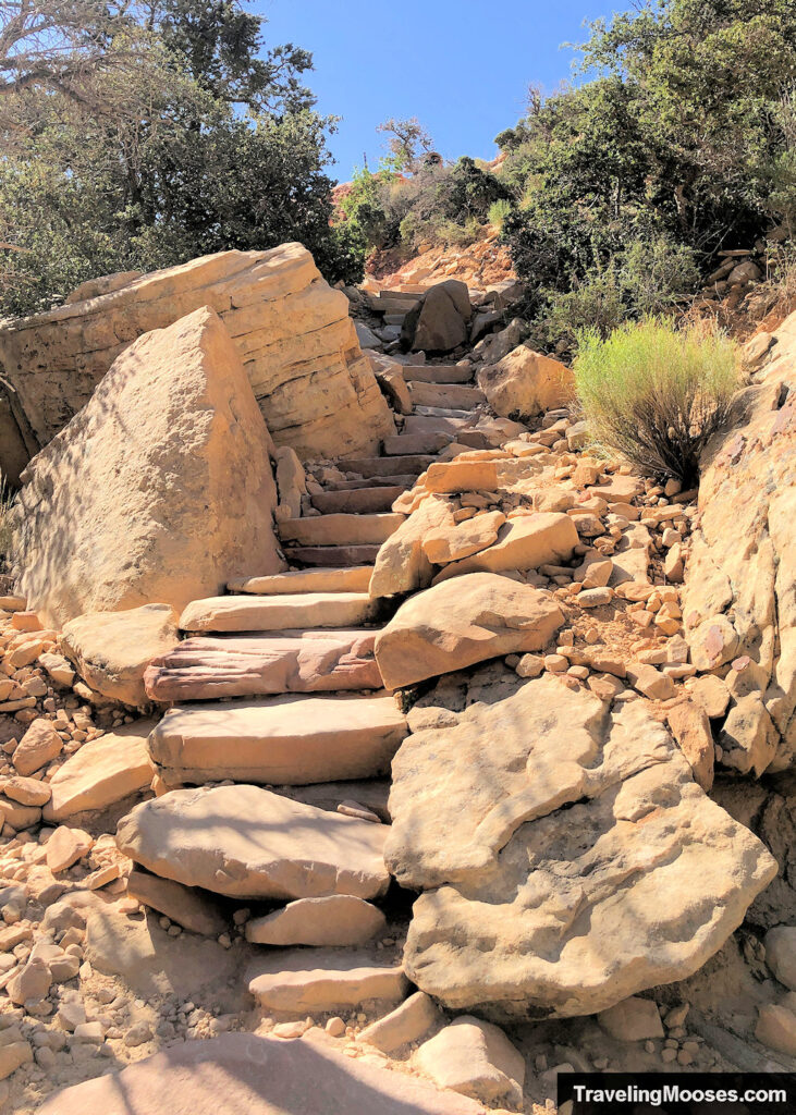
Mini Scrambles and Carved Steps
From here, the trail gets more interesting. You’ll pass through narrow sandstone corridors, climb carved stone stairs, and navigate a few light scrambles—nothing technical, but you might use your hands in spots.
If the ground is wet, the park advises not to climb the sandstone for 24-hours.
On a normal day, grippy shoes are helpful—though we saw a few flip-floppers somehow make it through.
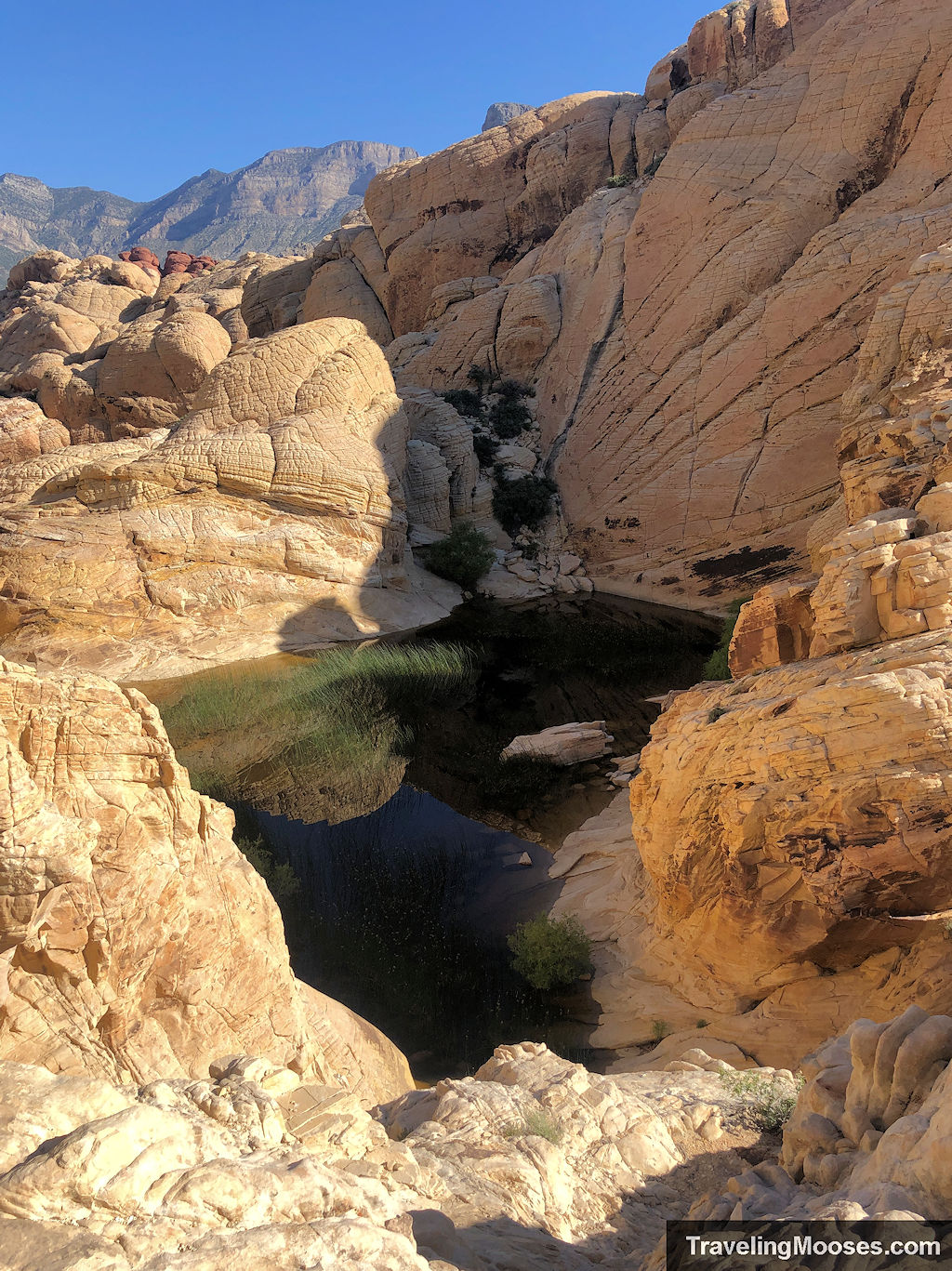
Reaching the Calico Tanks
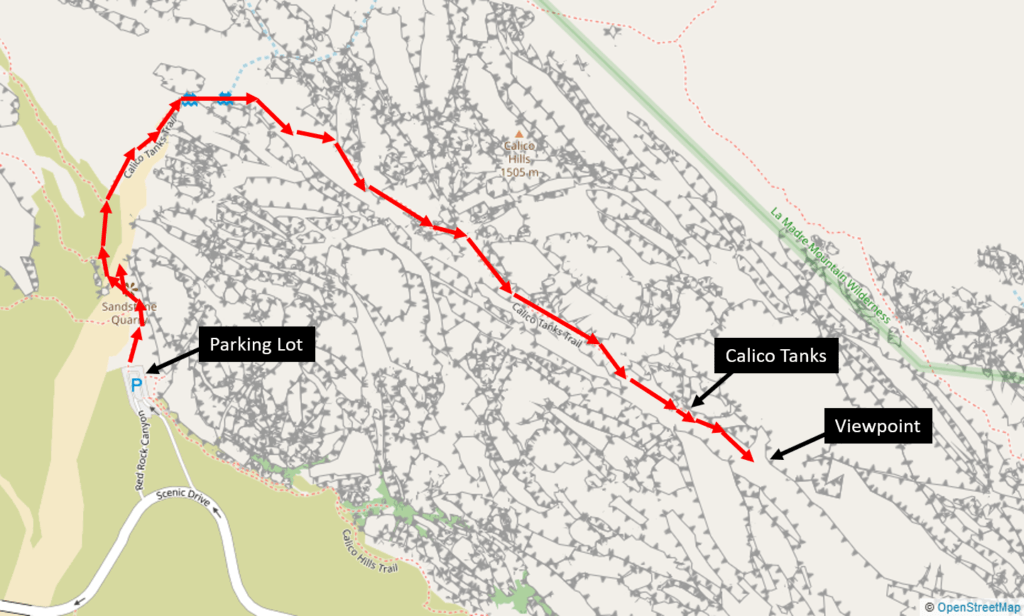
At about 1.1 miles, you’ll arrive at the tanks—a natural sandstone basin that fills with water after rain or during wetter seasons.
Some days, it’s a full reflective pool. Other times, just a dry depression. Either way, this is where the official trail ends… but not your hike.
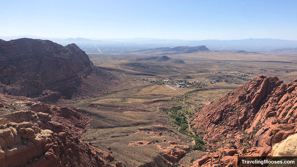
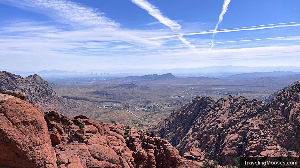
Vegas View Bonus (Don’t Miss This)
Head right around the tank and follow the faint path up and to the right for a short climb to the summit viewpoint. On clear days, you’ll see the entire Las Vegas Strip stretching across the horizon.
If you’re unsure where to go, wait for others or follow the most traveled route up—it’s more obvious when the tank is full.
From here, you’ll retrace your steps back to the lot.
🧭 Total round trip: about 2.2 miles
🕐 Time: 1.5 to 2 hours
🌅 Best time: Early morning for shade, spring or post-rain for water
Is Calico Tanks Trail Worth It?
Yes—with a few caveats.
If you’re looking for a short hike near Vegas that doesn’t require expert skills but still delivers epic views, Calico Tanks is a no-brainer. The mini scrambles, stone staircases, and surprise water basin (when it’s full) make it more engaging than most trails of this length.
But it’s no secret. This is one of the busiest trails in Red Rock, and depending on when you go, you may be sharing the experience with dozens of other hikers.
Moose Rating: 4 out of 5

What We Loved:
- The Vegas skyline reveal at the top
- Just the right amount of challenge: some scrambling, not overwhelming
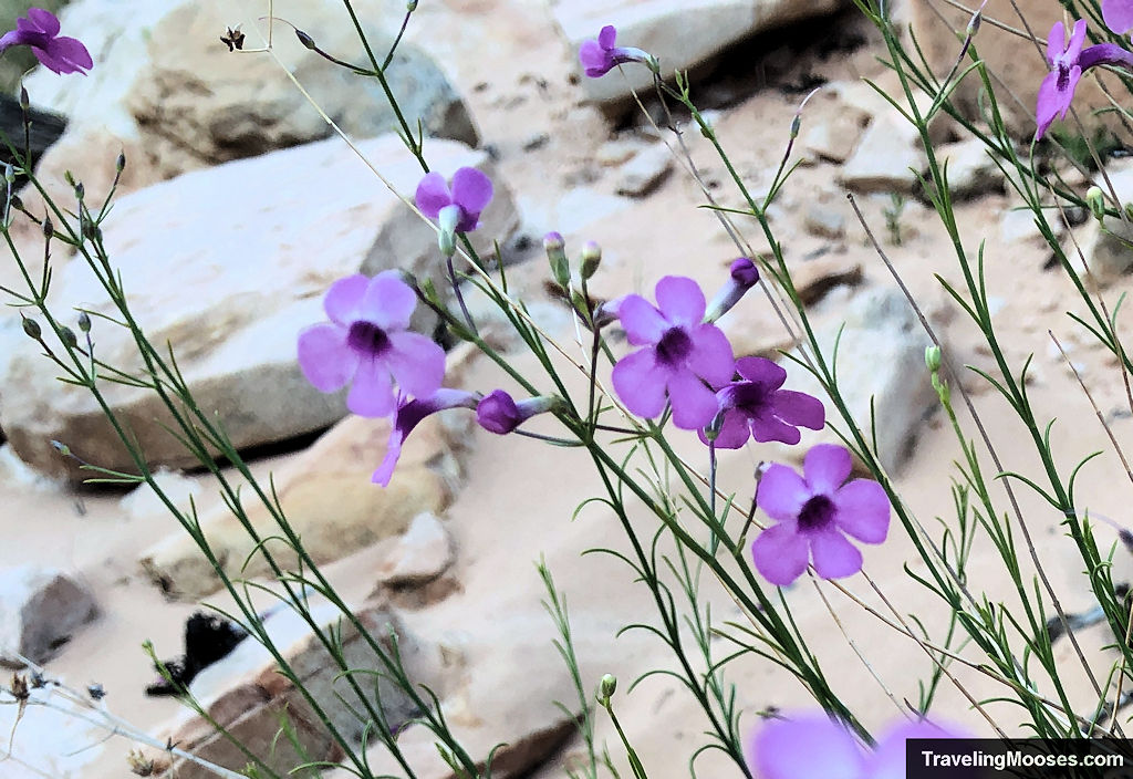
- Gorgeous terrain with layered red rock and desert flora
- Ample parking and clear signage at the trailhead
What to Watch Out For:
- Crowds—especially mid-morning and weekends
- No shade, so it’s rough in summer
- The tanks are seasonal, and might be dry when you visit
Verdict: It’s not a hidden gem, but it is a solid, scenic trail with enough reward to make the effort feel worth it—even if the tanks are dry.
How to Get to Calico Tanks Trail
The trailhead starts from the Sandstone Quarry parking lot, located about 3 miles into the Red Rock Canyon Scenic Drive. It’s the third main lot on the loop (or fourth if you stop at the Visitor Center).
From the Las Vegas Strip:
- Head west on Highway 592 (W Flamingo or Charleston) for ~8 miles
- Merge onto NV-159 W / Charleston Blvd
- Follow signs to Red Rock Canyon National Conservation Area
- Enter the park’s scenic loop (reservation required Oct–May)
- Look for Sandstone Quarry on your right
There are restrooms, signage, and usually plenty of parking—unless you arrive late on a weekend.
Pro Tip: Don’t Rely on Uber, Lyft, or Rideshare
We don’t recommend taking a rideshare to this trail (or anywhere in Red Rock Canyon). Here’s why:
- You’ll have to pay the entrance fee for the driver
- Cell service is spotty to nonexistent, making it hard to call for pickup
- Rideshare drivers generally can’t and often will not re-enter the scenic loop once they leave
- There’s no designated pickup area, and you might get stuck
If you don’t have a car, rent one—it’ll give you freedom to explore the whole park at your own pace or take a tour:
When to Go
- Best time: March through May or post-rainfall in cooler months
- Avoid: Midday in summer—there’s almost no shade
- Water in the tanks? Most likely in spring or after recent rain. Completely dry in summer/fall unless it’s been unusually wet.
Want the best chance at a peaceful hike and water in the basin?
👉 Go early (ideally before 9am), and time it after a storm if possible.
Crowds & Trail Traffic
Calico Tanks is one of the most popular hikes in the park, especially for visitors short on time. Expect:
- Busy mornings
- Groups at the summit viewpoint
- Bottlenecks at scramble spots
That said, many people turn around early—so the deeper into the trail you go, the thinner the crowds tend to get.
Calico Tanks Trail Map
You can find the route we took in the map below.
The trail official ends at the tanks, however most hikers climb up the sandstone rocks just behind the tanks to reach the sweeping cityscape views of the Vegas valley.
We do recommend downloading Alltrails to help you find your way. We have no affiliation with them, but we’re big fans after our incident on the Upper Gateway trail (nearby in Calico Basin).
It does work best if you purchase the full version to download the offline maps. Cell service in Red Rock Canyon is spotty.
Related: Read the things we do to increase our safety in the desert
Safety Considerations
Red Rock might feel close to Vegas, but it’s still wild land. Come prepared:
- After desert rain, do not climb sandstone for 24 hours.
- Flash flooding may occur during/after desert rain.
- Stay on designated trails.
- Cell phone service is unreliable.
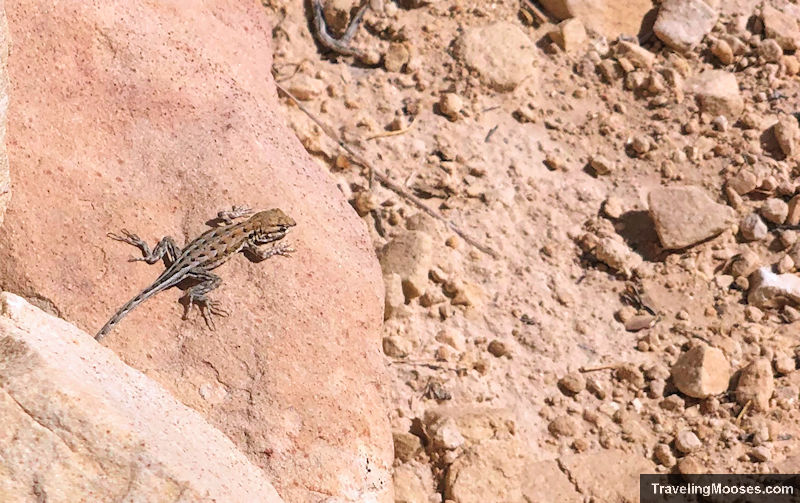
- Do not disturb or feed wildlife.
- Bring food/water, hiking shoes/boots, hat/sunscreen, and check in/out with family or friends.
Frequently Asked: Calico Tanks Trail
Why is it called Calico Tanks?
The name comes from the natural sandstone “tanks”—basins that collect rainwater seasonally. They’re carved into the red rock and can hold water for days or weeks after storms.
You might find a full pool, a muddy puddle, or nothing at all depending on the season.
Do I need a reservation?
Yes—between October 1 and May 31, Red Rock Canyon requires timed entry reservations for the scenic loop. You can book them in advance at recreation.gov.
Can I bring pets?
Yes—dogs are allowed on-leash. But remember: this trail has exposed rock, no water, and no shade. Avoid hot days to protect their paws.
Other Red Rock Hikes You Might Like
If you enjoyed Calico Tanks, Check out:
- Ice Box Canyon: Shady and rugged with a waterfall (in spring after rainfall)
- Keystone Thrust Trail: Quieter with geoloic history and ridge views
- Turtlehead Peak: Same trailhead, much steeper climb, epic views
- Pine Creek Canyon Trail: Seasonal water, rugged rocks, less visitors
Or if you want more photo spots and shorter stops:
More Info:
Calico Basin (entrance is currently free)
- Red Spring Boardwalk (Picnic area / photo spot, short walk and jumping off point for other hikes).
- Hiking: