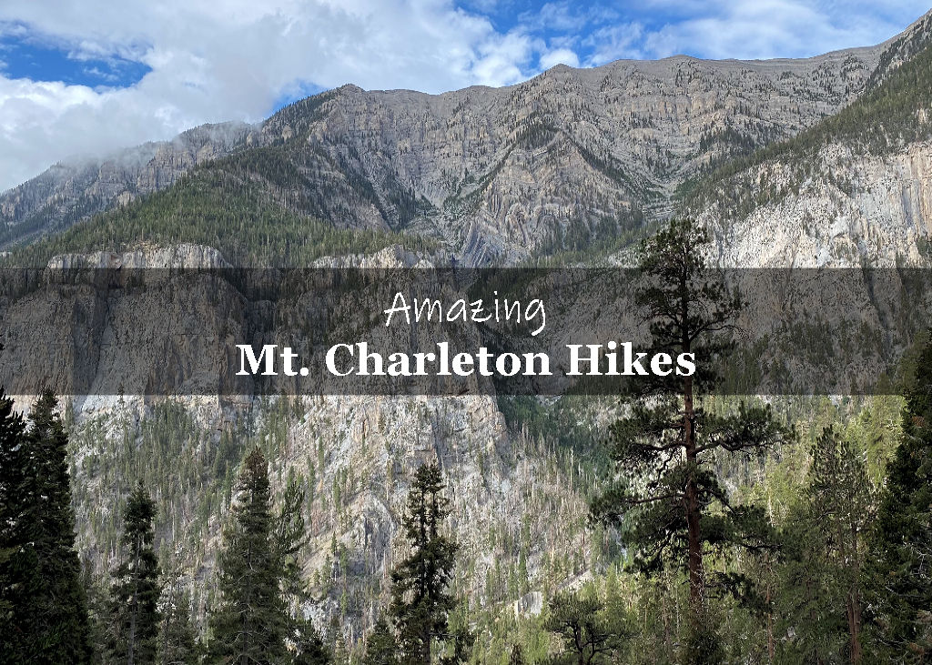
Updated June 2025 to include more trail insights and practical planning tips for hikers tackling Griffith Peak this season.
Griffith Peak shares the same route as Charleston Peak via the South Loop Trail, diverging only at the final saddle. While both summits follow the same strenuous approach, Griffith offers a rewarding summit that requires less time and effort—making it a great goal for hikers who want big views without committing to the full 17+ mile Charleston trek.
Griffith Peak Trail Stats
| Trail description | Out and back |
| Location | Griffith Peak – Mt. Charleston, NV 89124 |
| Parking lot & Trail Start | Cathedral Rock Trailhead, Mt. Charleston, NV 89124 |
| Round trip mileage | ~10 miles (Varies by GPS) |
| Average time | 6 – 8 Hours |
| Difficulty | Strenuous – The trail is considered strenuous due to the max elevation and uneven ground. Higher elevations are tougher to hike in. The trail includes switchbacks and some roughly made stone stairs. |
| Elevation gain | ~3,413 feet |
| Elevation start | ~7,651 feet |
| Elevation max | 11,064 feet |
| Best time to visit | Late June through Mid-September (Note: The trail closes in the winter months) |
| Amenities | Free parking (limited), primitive restrooms, trash receptacle, trail information |
| Entrance Fee | Free |
| Rating | 4.0 Mooses |
Why hike Griffith Peak?
Sweeping views of the Las Vegas Valley, Cathedral Rock, Mummy Mountain, and Charleston Peak
Slightly shorter than Charleston Peak, with a similar challenge
A perfect training hike for high-elevation treks
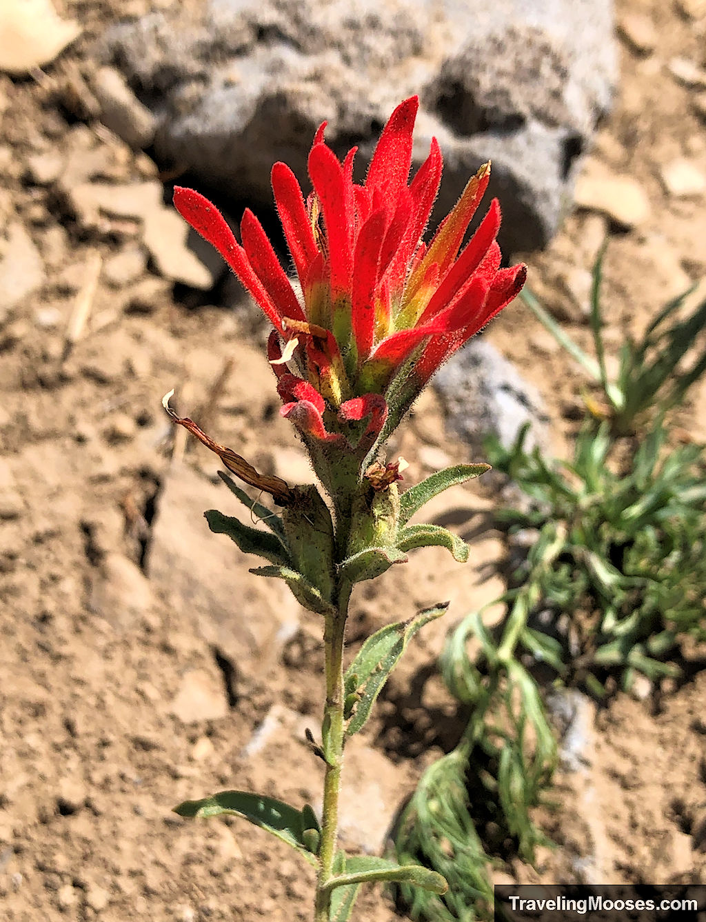
Access to seasonal wildflowers, possible wildlife sightings (including the endangered Mt. Charleston Blue Butterfly), and scenic rock formations
Trail Overview
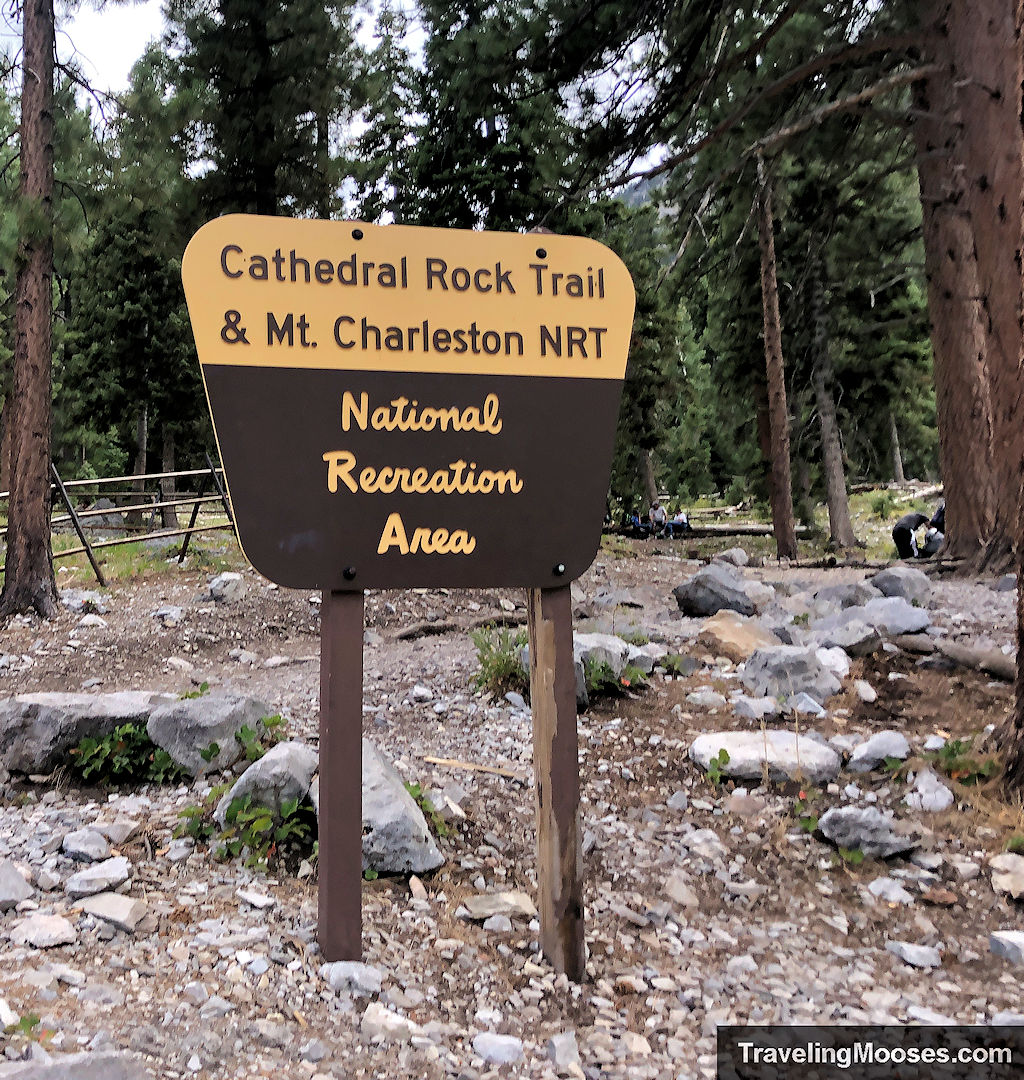
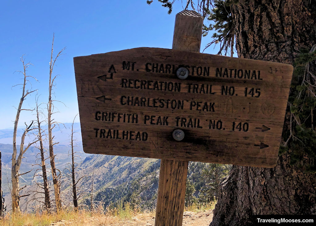
Start at the Cathedral Rock Trailhead, which shares parking with the South Loop Trail. Look for the sign marked “Mount Charleston National Recreation Trail.” From here:
- To Echo Overlook (2.3 miles in):
- Steady incline, moderate switchbacks
- Stunning views of Echo Cliffs, wildflowers, and possible wildlife
- A great turnaround point if you’re short on time
- Echo Overlook to Saddle (~2.5 more miles):
- Intense elevation gain continues
- Exposed sections, thinner air, and increasing views
- Trail becomes rockier—watch your footing
- Final Push to Summit (~0.7 miles):
- The last 400 feet of gain happen fast
- Fully exposed ridgeline with epic views in every direction
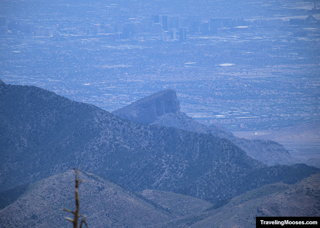
🏔 On clear days, you may spot the Las Vegas skyline and even Turtlehead Peak from the summit.
Interactive Trail Map
Below is a map of our route from the Cathedral Rock trailhead up to the summit of Griffith Peak. If you can’t see the map below, you can view it directly in Google Maps here.
What it’s really like (A local’s take)
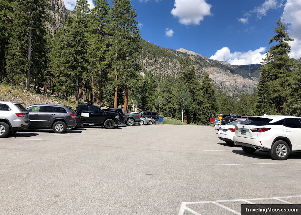
If you’re planning to hike Griffith Peak, expect a challenging but highly rewarding adventure. We visited on a holiday weekend and arrived just after 7 a.m.—there were only 6–10 parking spots left.
Overflow parking is about 0.3 miles down the road, but there’s no sidewalk, so it’s best to get there early.
Cathedral Rock Trailhead to Echo Overlook
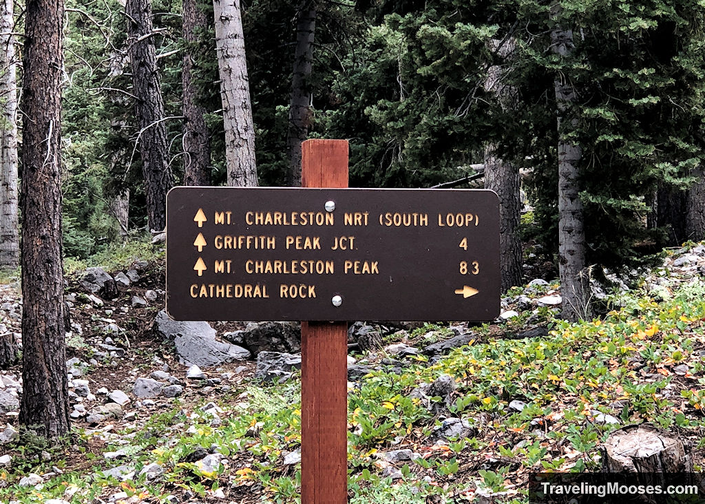
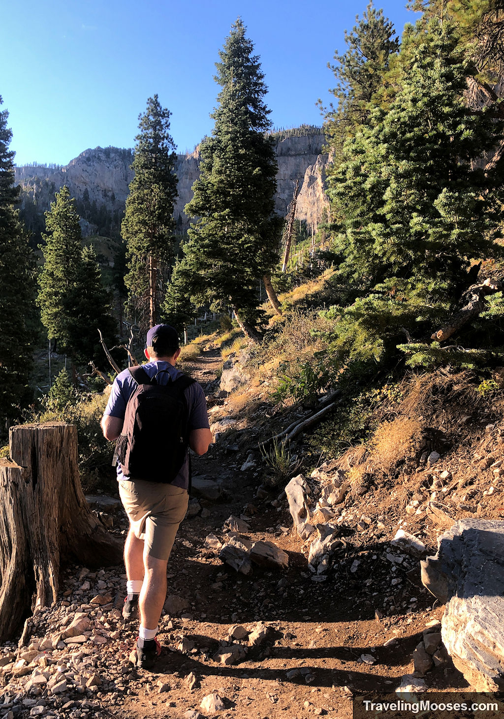
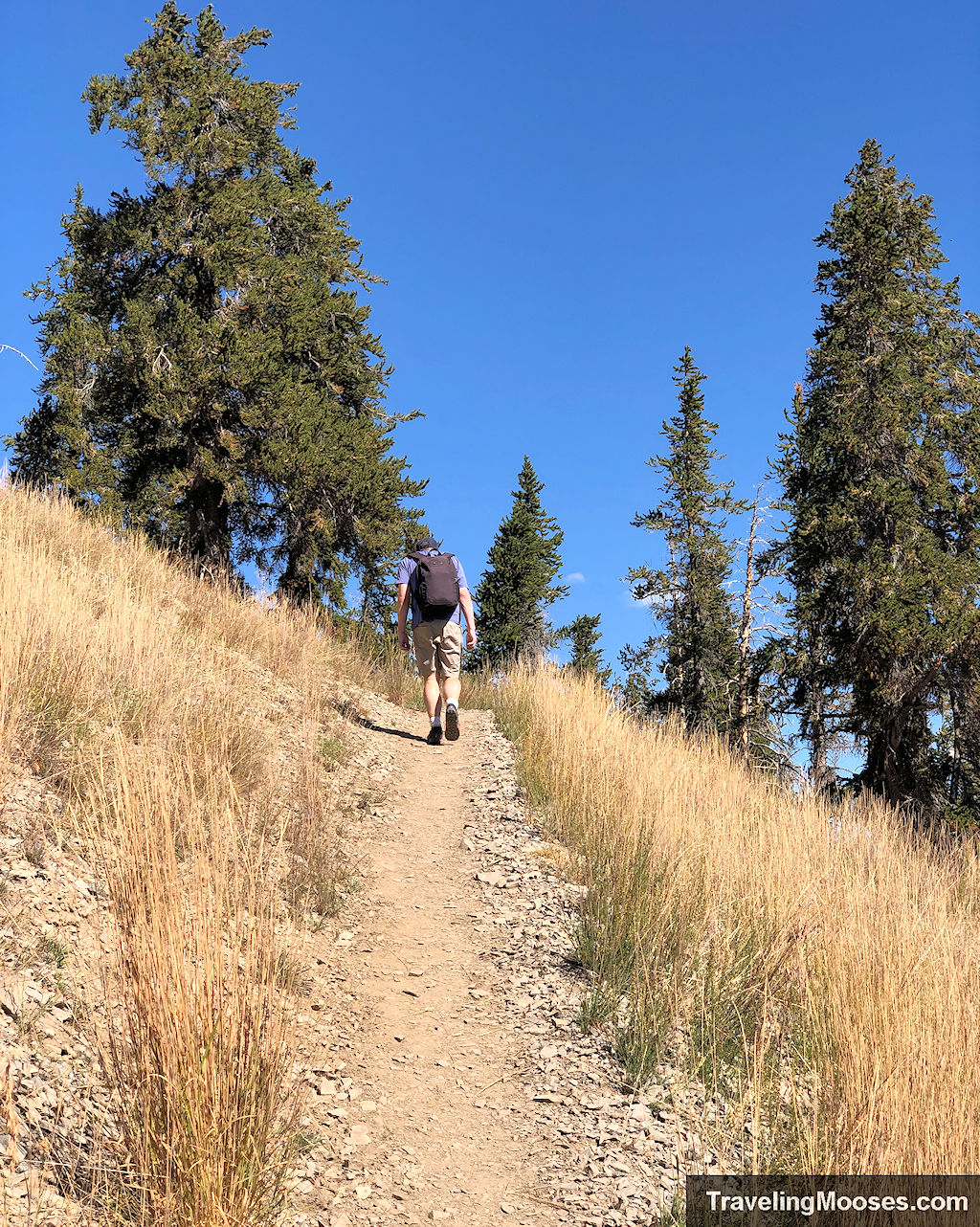
The trail shares the same start as Cathedral Rock, but at the first fork, you’ll head left onto the South Loop Trail. From here, the elevation gain kicks in almost immediately. Expect a mix of steady switchbacks and rocky, uneven trail underfoot. It’s not technical, but it will test your endurance—especially at altitude.
Related: How to hike Cathedral Rock
You’ll notice the elevation gain starts immediately after the trail fork.
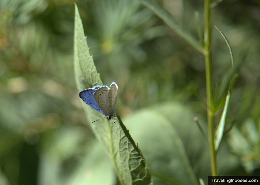
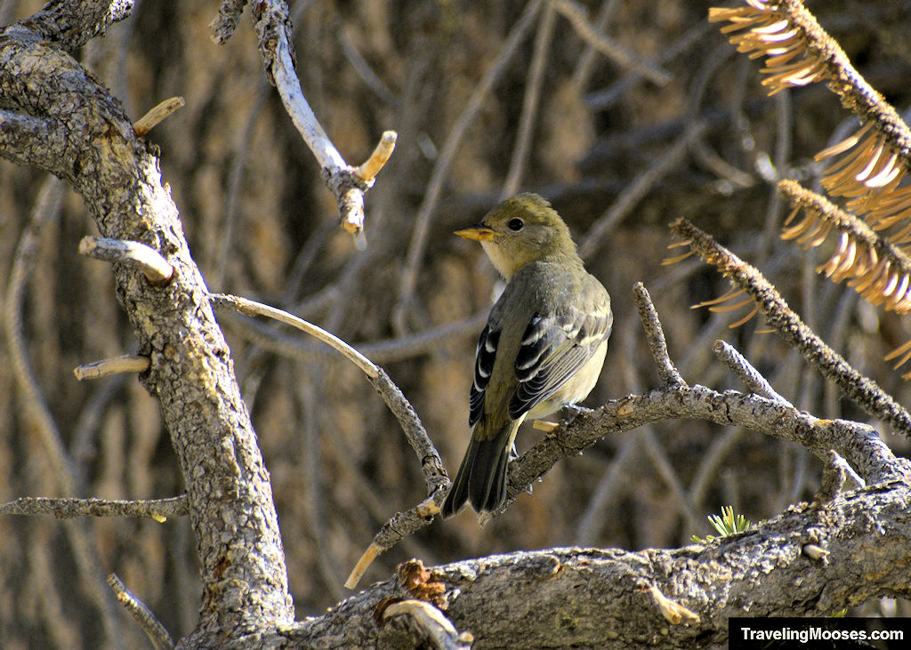
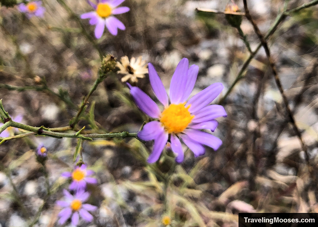
The early stretch winds past cliffs and meadows filled with wildflowers in season. One unique highlight: this is one of the only places in the world you might spot the endangered Mount Charleston Blue Butterfly. They’re most active in late July and early August.
We have seen them on the South Loop trail before, but weren’t able to capture a photo. Here’s one from a trail close by.
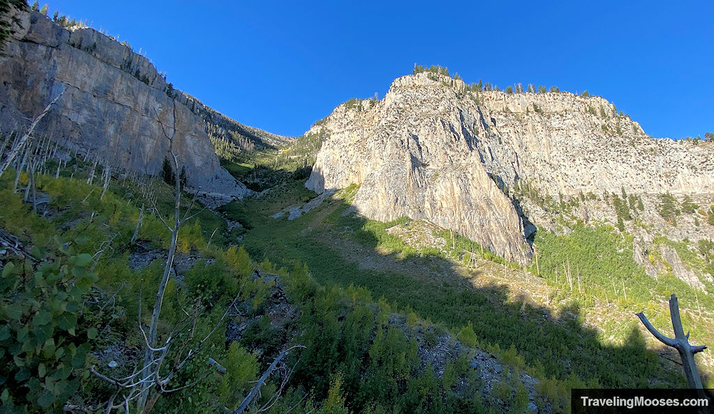
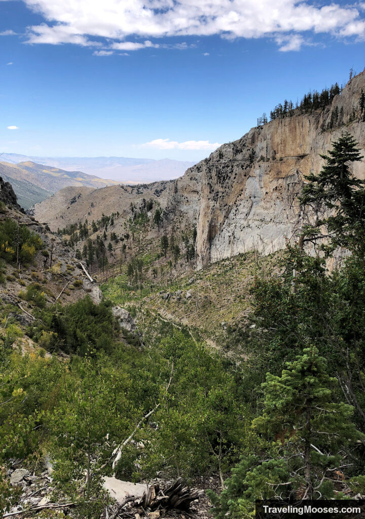
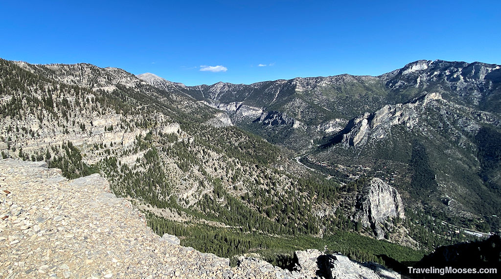
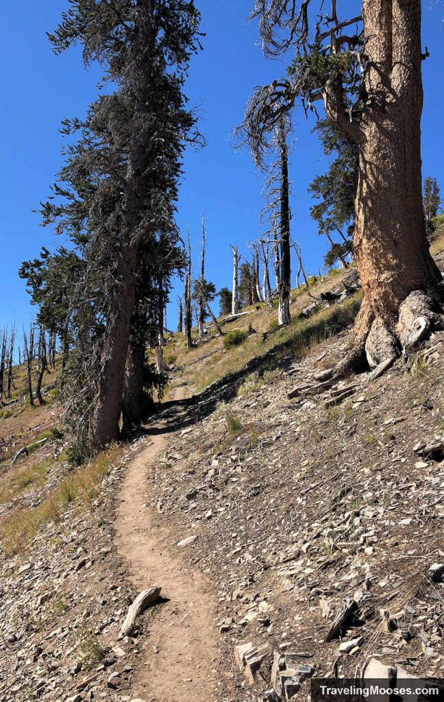
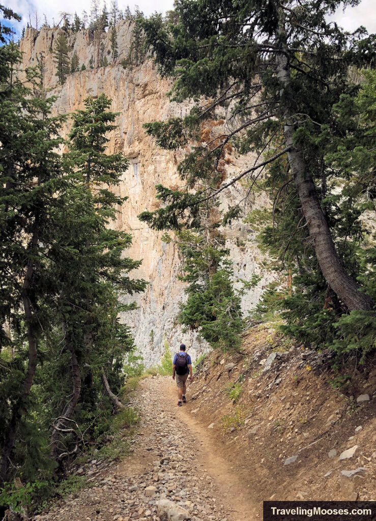
As you progress along the trail, you’ll see a large prominent rock feature, Echo Overlook. You’ll wrap around the back after a series of switchbacks to reach the viewpoint.
Be sure to turn around often and enjoy the views of the valley.
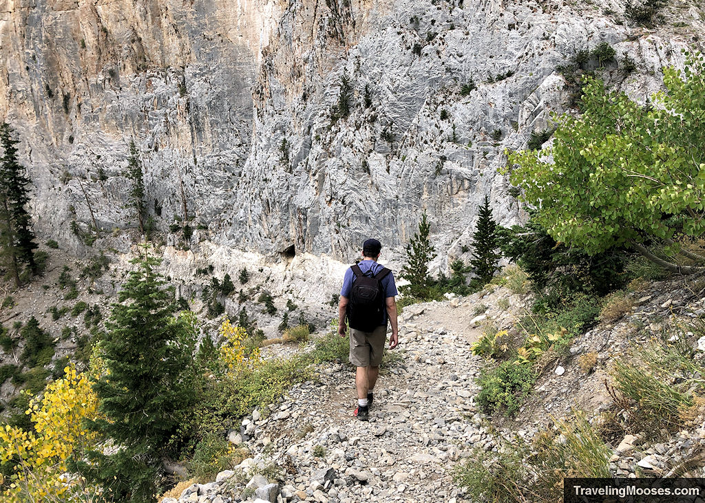
Around 2.3 miles in, you’ll hit Echo Overlook—one of the most scenic parts of the trail and a popular turnaround point. There’s a small cave in the cliff walls before the overlook and a seasonal stream nearby.
Note: We did not attempt to climb up into the cave. It didn’t look safe to us, but we were wondering how many people had attempted to explore inside.
The stream is accessible off the trail; you’ll just need to keep your eyes peeled for a cutoff along the switchbacks. It’s not an official part of the trail, so always use caution exploring.
It won’t take long before you arrive at the overlook.
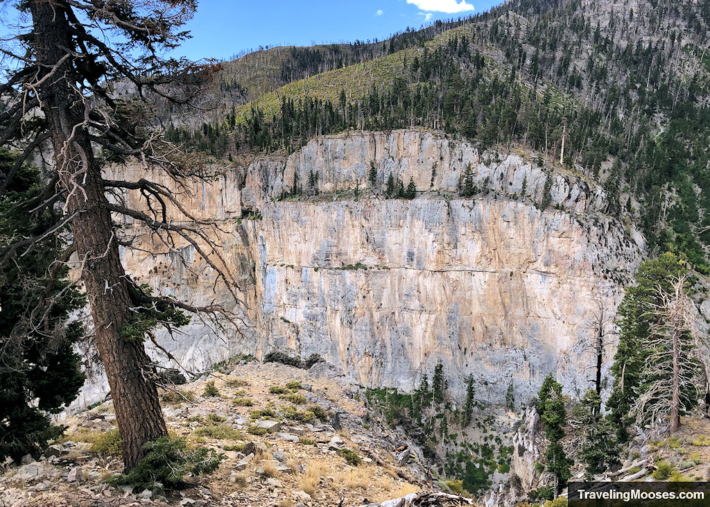
Cathedral Rock and Mount Charleston will be to the west. If you have binoculars, you can see people on top of Cathedral.
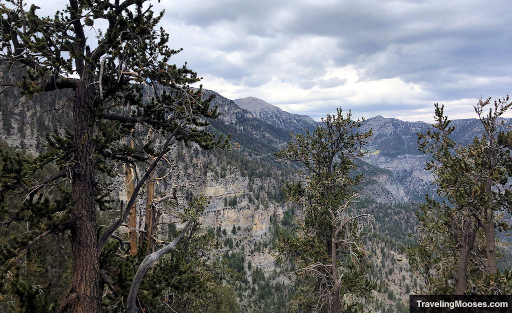
Warning: Be careful walking around Echo Overlook – there are no guardrails and the ground can be slippery. Mummy Mountain can be seen to the north.
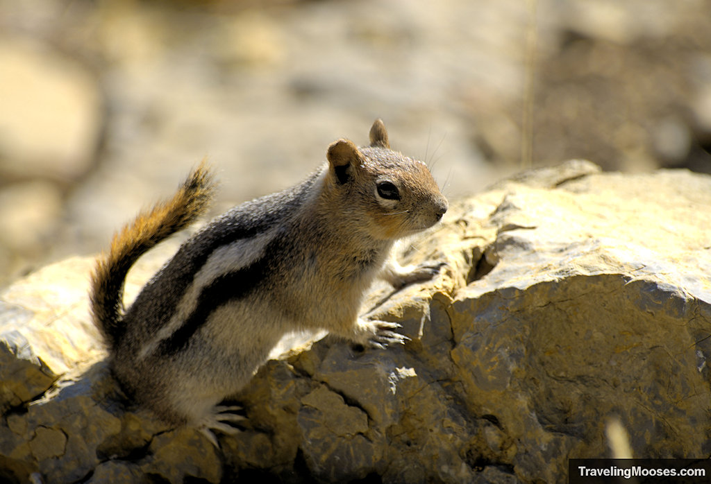
Echo Overlook is sometimes used for overnight camping (we’re not sure what the rules are – but we saw some tents the day we visited). This stop is also where we often find wildlife (butterflies, squirrels and birds).
At Echo Overlook, the total mileage is around 2.3 miles and 1,400 feet in elevation. We felt this was the most scenic part of the trail and it’s a great place to turn around if you’ve not feeling like continuing up to Griffith Peak.
Read more about Echo Overlook.
After a quick break and enjoying the views, it was time to continue the uphill march to the summit of Griffith Peak.
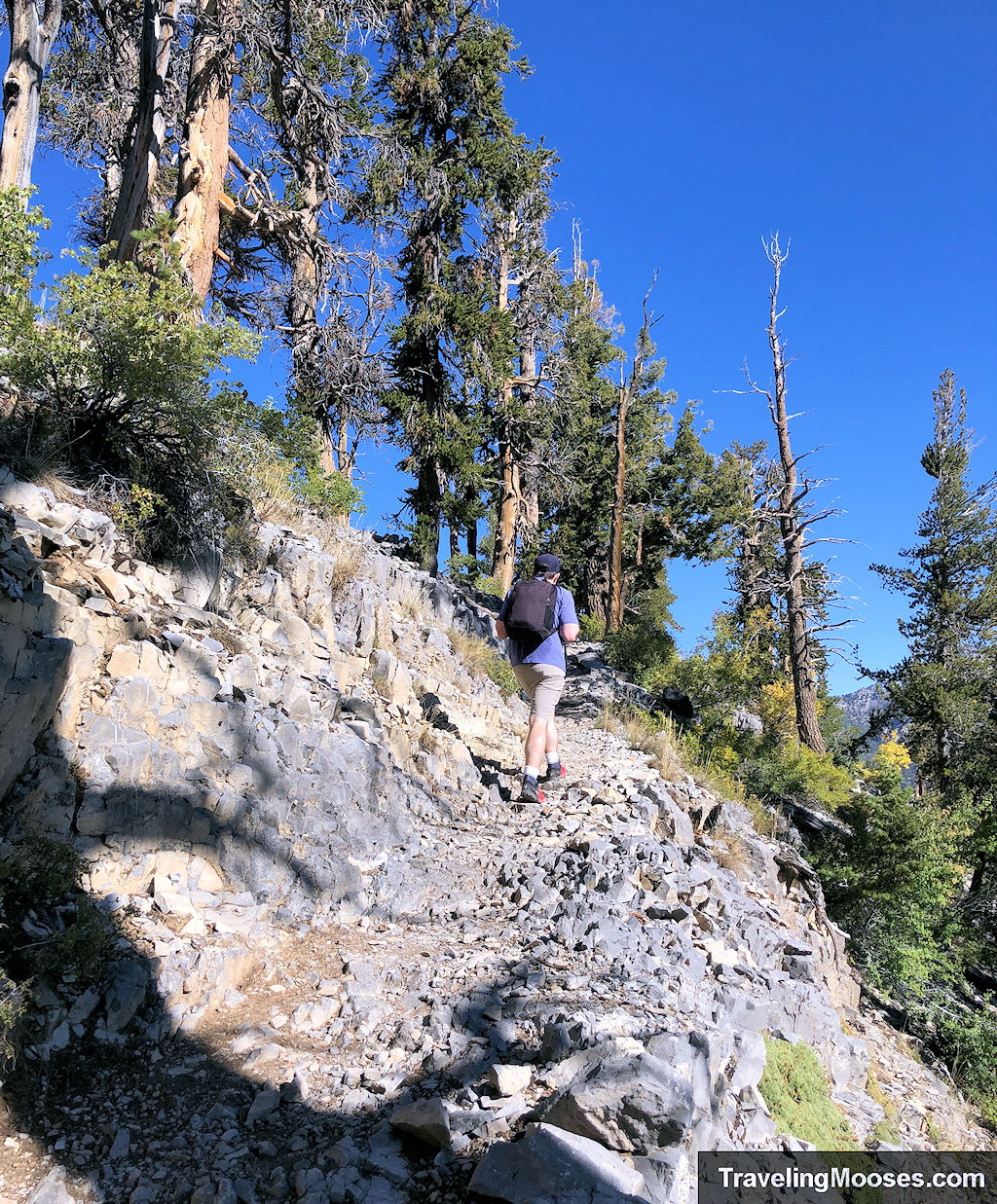
Echo Overlook to Griffith Peak Junction
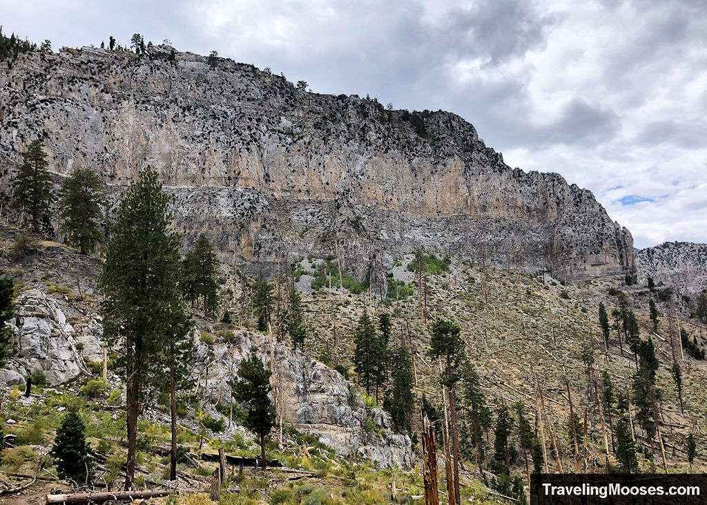
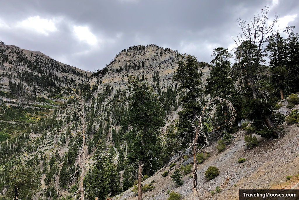
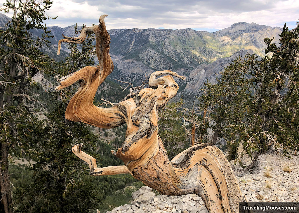
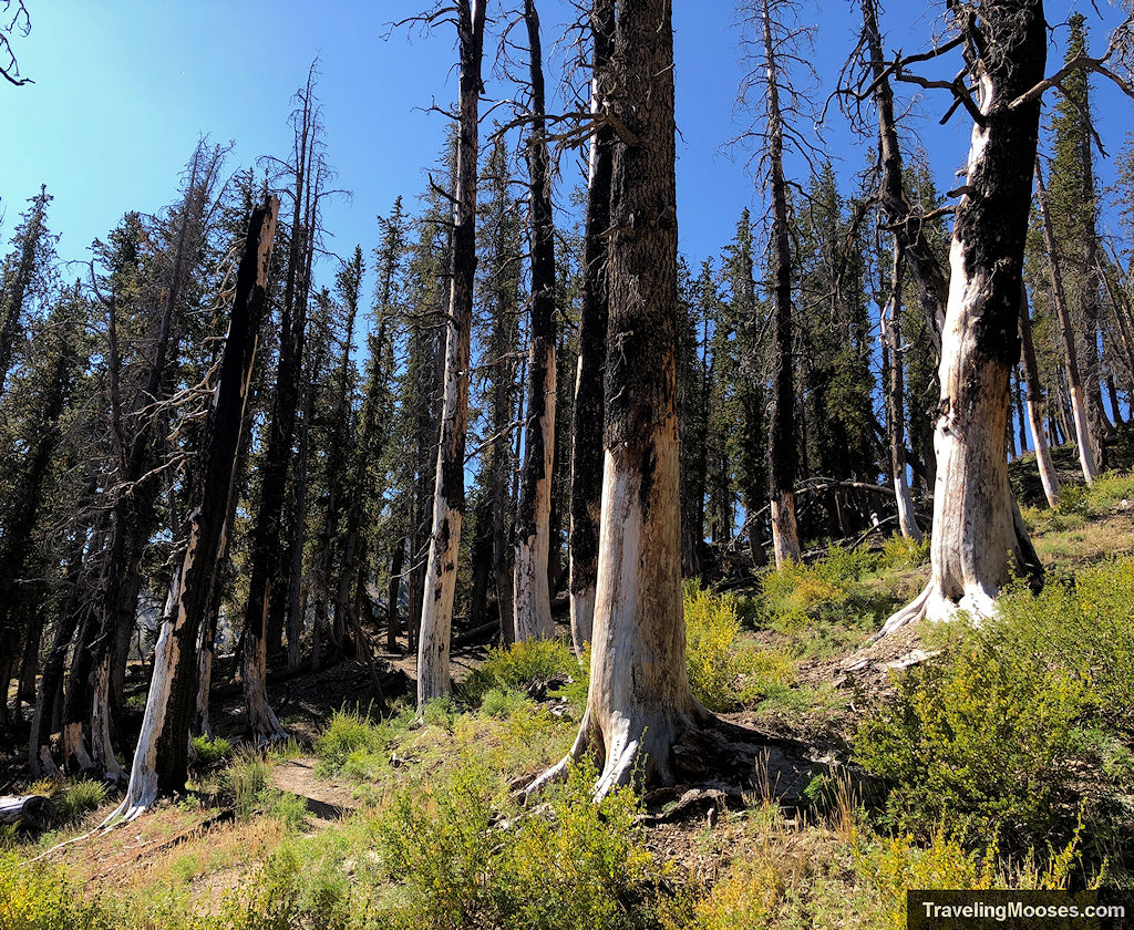
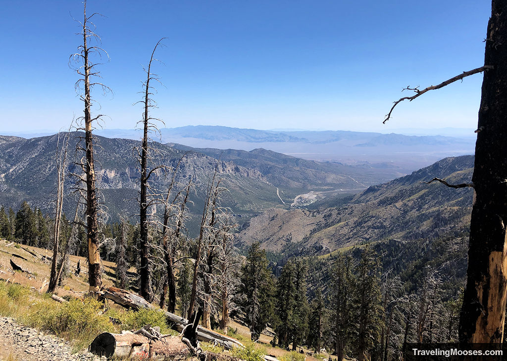
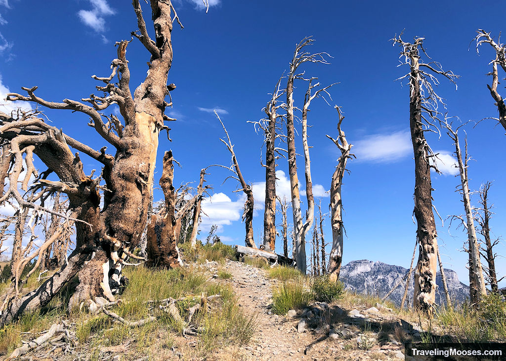
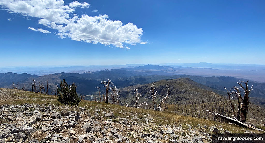
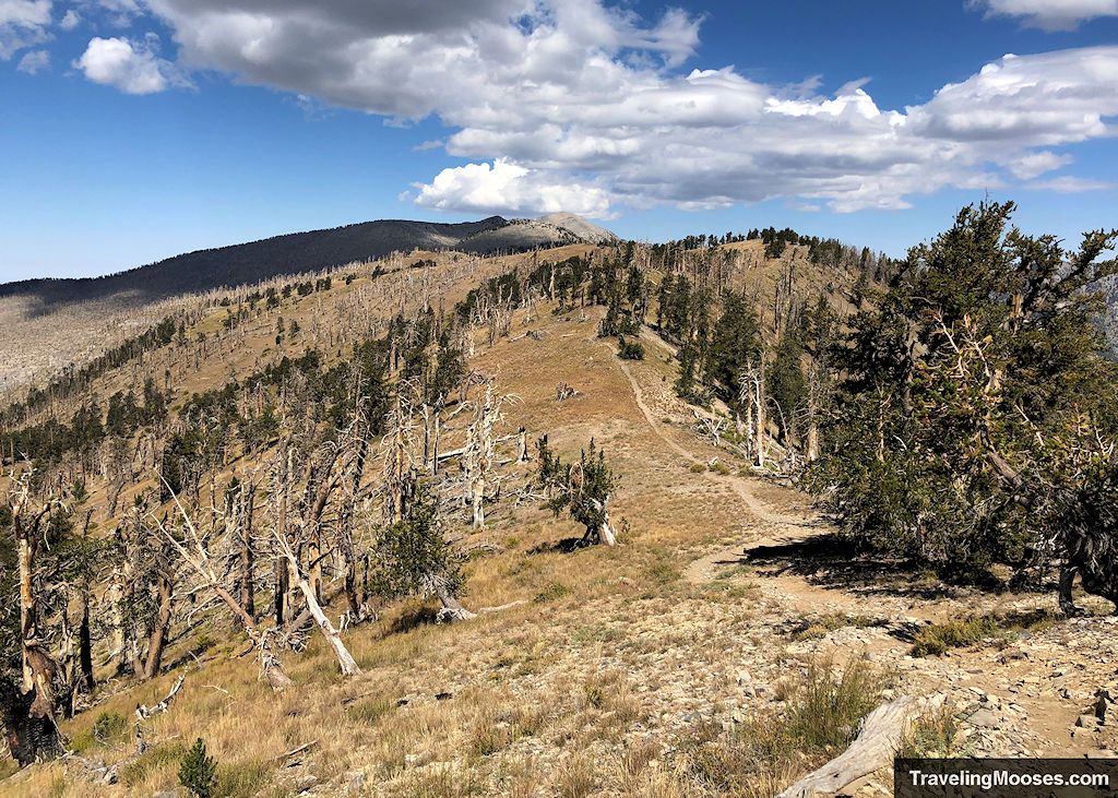
After Echo, the trail gets more demanding. Switchbacks increase, views expand, and you’ll begin seeing signs of past wildfire damage as you near the saddle. We joked about it being reminscent of Disneyland, except their paths are relatively flat and these are most certainly not.
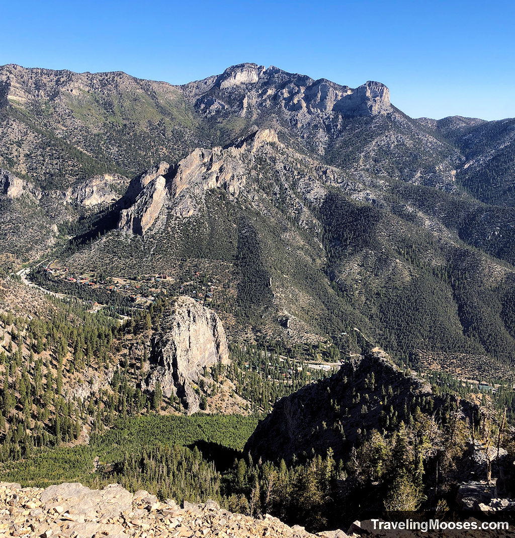
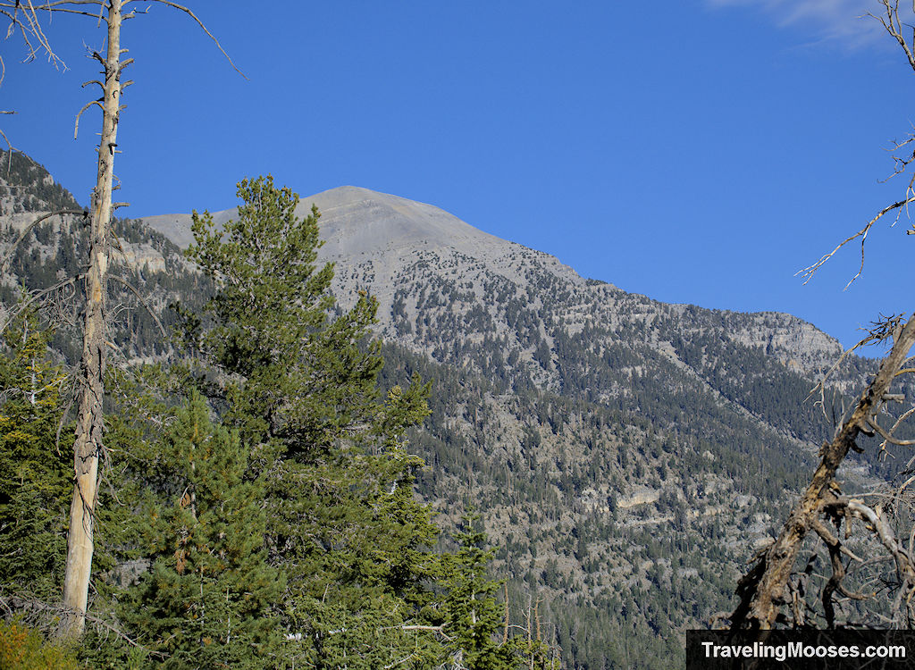
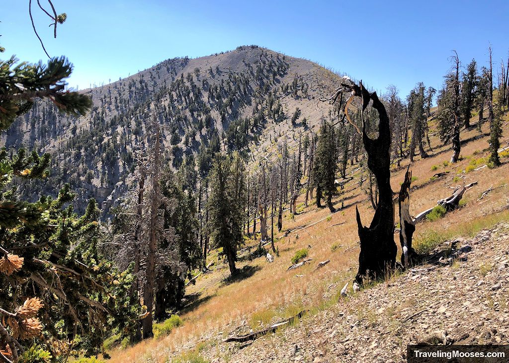
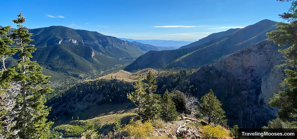
The scenery here is some of the most expansive on the hike, with great views of Charleston Peak.
Along the way, you’ll find two natural areas to stop for a break that include better views of Mount Charleston than at Echo Overlook.
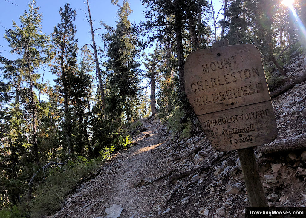
Next up, you’ll reach the boundary sign for the Mount Charleston Wilderness area and the switchbacks will continue all the way to the saddle.
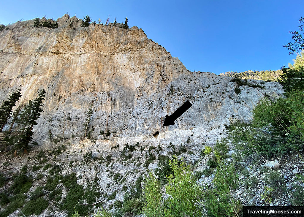
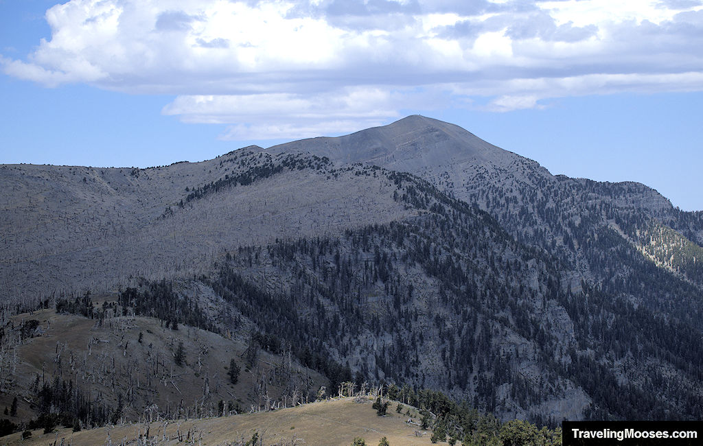
Nearing the saddle, the first glimpse of Griffith’s peak finally comes into view. Yes, we’re going all the way up there.
Continuing up the trail, it will get steeper as you approach the saddle and the final trail junction. The trees become thinner and you’ll be more exposed to the elements. The day we visited, the temperatures were mild and the winds low. This is often not the case.
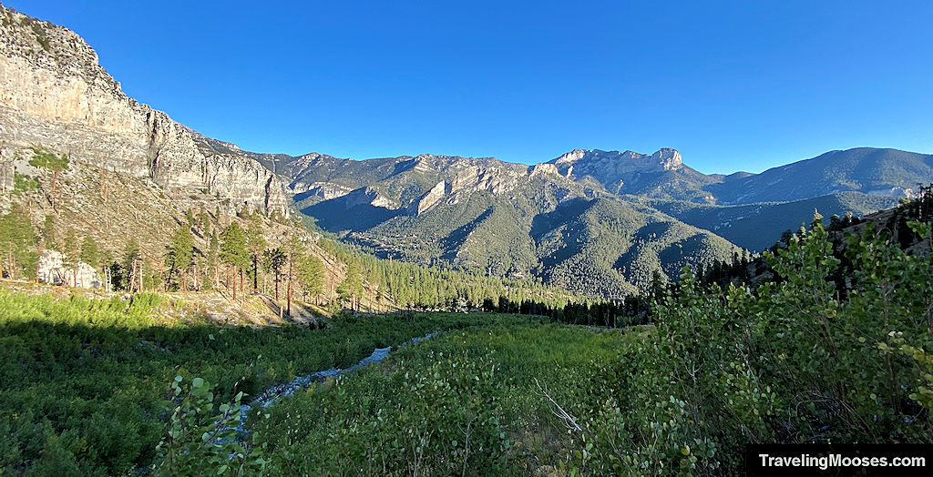
Finally reaching the saddle, we had achieved a total of 3,000 feet elevation gain and a view of the final hurdle to reaching the summit.
This is another great spot for a break and to soak in the views.
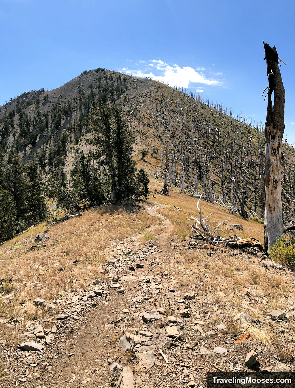
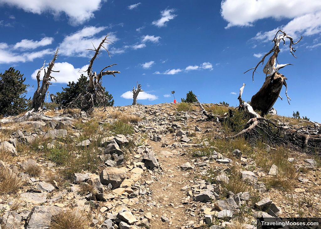
Final push to Griffith Peak Summit
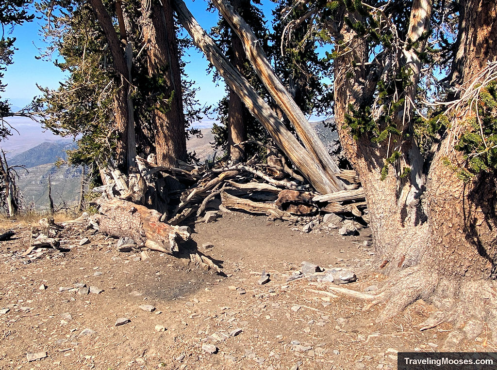
At the saddle, you’ll find a junction: left continues on to Charleston Peak, right takes you to Griffith. There’s also a windbreak made from fallen logs and some flat ground where backpackers sometimes set up tents.
The final 0.7 miles to the summit are fully exposed and deceptively tough. Even though the distance isn’t far, the elevation and loose terrain slow things down. It took us about 20 minutes to reach the top from the saddle.
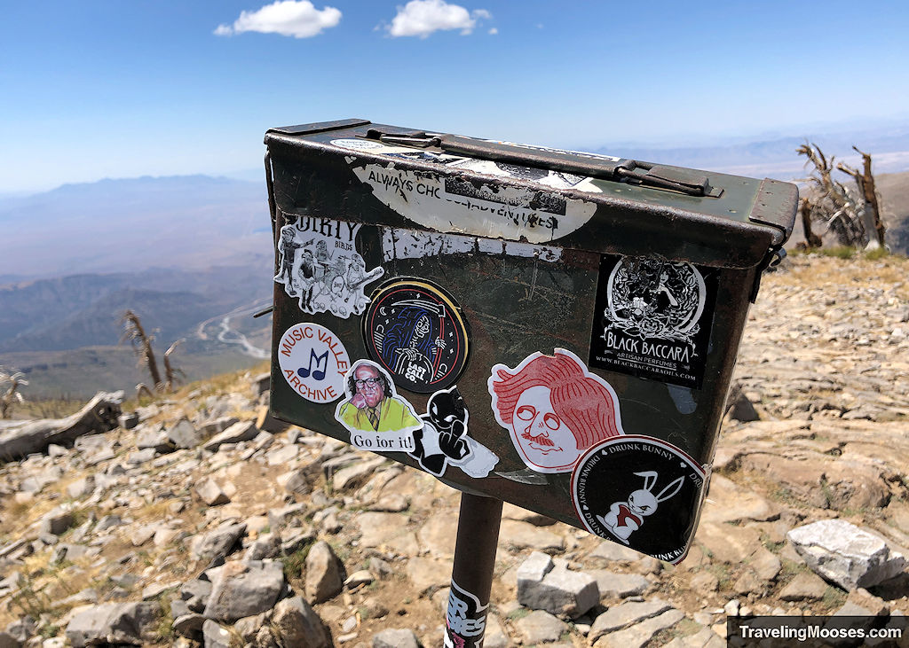
Griffith Peak Summit
Reaching the summit is always a welcome sight. There’s plenty of room to spread out if it’s busy, but the day we were there we had the summit all to ourselves for quite some time.
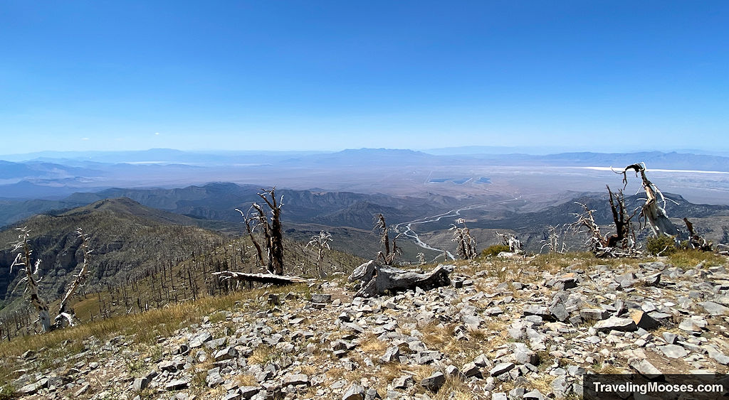
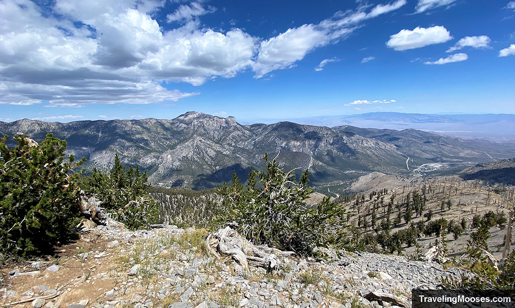
On a clear day, you can see the Vegas skyline from the summit. Plus, we can’t resist seeing Turtlehead Peak from another vantage point. Turtlehead was one of the first peaks we conquered after moving to Vegas.
We enjoyed some lunch and soaked in the views before beginning the long trek down to the trailhead.
The Way Back Down
Trekking poles helped a lot on the descent—especially between the summit and saddle. The rocky footing is rough on the knees, and you’ll be ready for those poles by then.
Despite the length, the return hike through Echo Cliffs is just as enjoyable.
We arrived back at the trailhead around 7 hours and 40 minutes after we started.
Practical info for your trip
Current trail conditions
- Check GoMtCharleston for current closures or restrictions.
- Check Alltrails for recent trail conditions.
- Check the official weather website GoMtCharleston recommends for temperature forecasts.
What to bring
Essentials:
- Plenty of water (3L minimum in summer)
- High-energy snacks or lunch
- Sun protection: hat, sunglasses, sunscreen
- Navigation: map, GPS, or Alltrails+ (no affiliation)
- Trekking poles
Clothing:
- Layered clothing (alpine temps shift fast)
- Windproof jacket
- Sturdy hiking boots or trail runners with grip
Optional:
- Binoculars (for Cathedral Rock & wildlife viewing)
- Lightweight sit pad or wind shelter for summit breaks
Parking
There is free parking at the Cathedral Rock trailhead, however it is limited. When its full, hikers park down the street and along the road. Be sure to follow all posted signs as some parking along the road is subject to towing. We recommend getting to the trailhead early as you’ll add an additional 0.6 miles round trip for the overflow parking.
Best Photo Ops
- Echo Overlook (~2.3 miles in)
- Charleston Peak vistas near the saddle
- Ridgeline to the summit
- Summit views toward Vegas and Turtlehead Peak
Trail Map
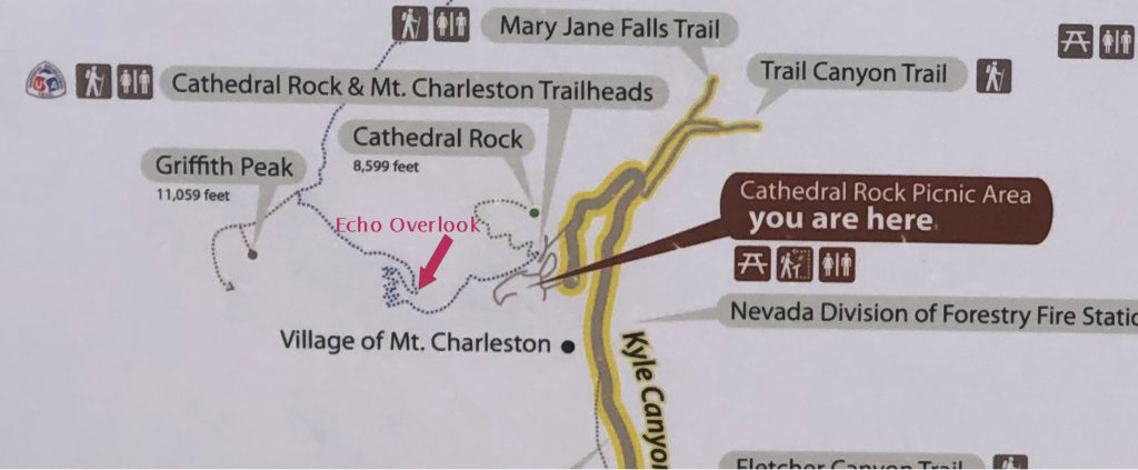
In addition to the interactive trail map found at the top of the article, we’ve included a snapshot of the official trail map. We felt the trail was well marked and we didn’t have any issues finding the summit.
Trailhead Amenities
- Two parking lots, one with about 50 spots and one with around 25
- Trail Information and trail map of surrounding areas
- Primitive restrooms
- Trash receptacle
- Benches
- Water spigot
- Nearby to the Fletcher View Campground and Cathedral Rock Picnic Area
- Trail starts for Cathedral Rock and South Loop trailhead which includes access to Echo Overlook, Griffith Peak and Charleson Peak.
- Overflow parking is available approximately 0.3 miles down the paved road (0.6 miles round trip)
Trail Tips
A few tips are posted on the information sign boards at the trailhead:
- Plan Ahead: know where you’re going and what conditions you may encounter. Let someone know your plans and when you’ll be back.
- Pack Smart:
- Layers of protective clothing (warm and wind-proof)
- Sturdy hiking shoes
- Sunglasses and sunscreen
- Plenty of water (more than you think you’ll need)
- Food
- First aid kit
- (For longer hikes): camping gear, or emergency overnight gear
- Cell phone
- Pace yourself: know your own limits and stay well within them…save plenty of energy for the return trip. If in doubt, turn around.
While we didn’t see any other recommendations, other trails in the Spring Mountains area offer a few extra tips:
- Bring a Flashlight – Allow for ample hiking time.
- Leave wildflowers, plants and artifacts. Please leave these behind to be enjoyed by others.
- Take photographs and memories and pack out any trash.
- Stay on trails.
Final Verdict
Rating: 4.0 Mooses
What we liked:
- The first few miles through the Echo Cliffs and up to Echo Overlook are always a highlight—scenic, quiet, and varied.
- The switchbacks, while challenging, are generally well-graded and manageable.
- Multiple scenic payoff points: Echo Overlook, the saddle, and of course the summit.
- Panoramic summit views stretch from the Vegas skyline to Turtlehead Peak and beyond.
- It’s a fantastic training hike for longer summits like Charleston Peak.
What we didn’t like:
- The descent feels long, especially on the rocky, repetitive switchbacks.
- Some seasonal highlights (like wildflowers or fall color) are easy to mistime if you’re not local.
- The final summit push, while short, can feel a bit rough due to exposure and elevation.
Is it worth it? Yes—if you’re seeking a big, rewarding climb without the full Charleston commitment. Come prepared, pace yourself, and you’ll walk away with a summit worth remembering.
More info for your trip to Mt. Charleston
We’ve created a lot of guides and fun things to do in the Mount Charleston area. Check out some of them below.
You might also like