

Las Vegas is surrounded by five major hiking regions, each with a completely different landscape, vibe, and difficulty profile. If you’re deciding where to go, this guide gives you the highlights written by a local.
The 5 Hiking Regions Around Las Vegas
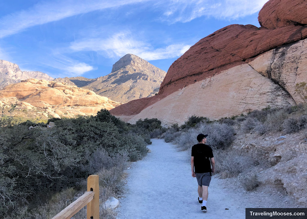
1. Red Rock Canyon (Closest & Most Popular)
Best for: First-time visitors, short hikes, dramatic red rock, with optional rock climbing
Distance from Strip: ~25 minutes
Pass required: Yes
Why choose Red Rock:
Red Rock delivers the signature red sandstone, slot canyons, and scenic loop that most visitors imagine when they picture “Vegas hiking.” Trails range from quick walks to scrambling routes. It’s the busiest region by far so go early to beat the crowds.
Go here if you want:
✔ Iconic red rock scenery
✔ Beginner to moderate trails
✔ Well-marked paths close to the Strip
Skip if:
You want solitude or hate crowds.
Popular hikes in this region:
– Calico Tanks
– Ice Box Canyon
– Pine Creek Canyon
– Keystone Thrust
→ Want details?
See our Complete Guide to Red Rock Canyon (best hikes, park fees, driving tips, and what to expect).
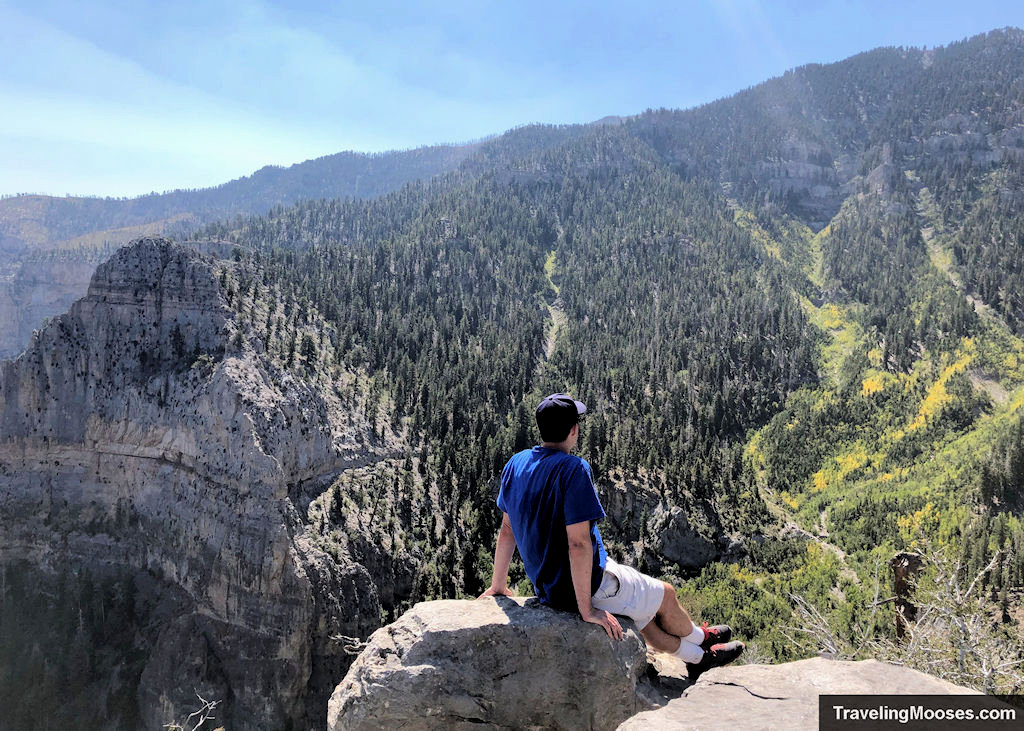
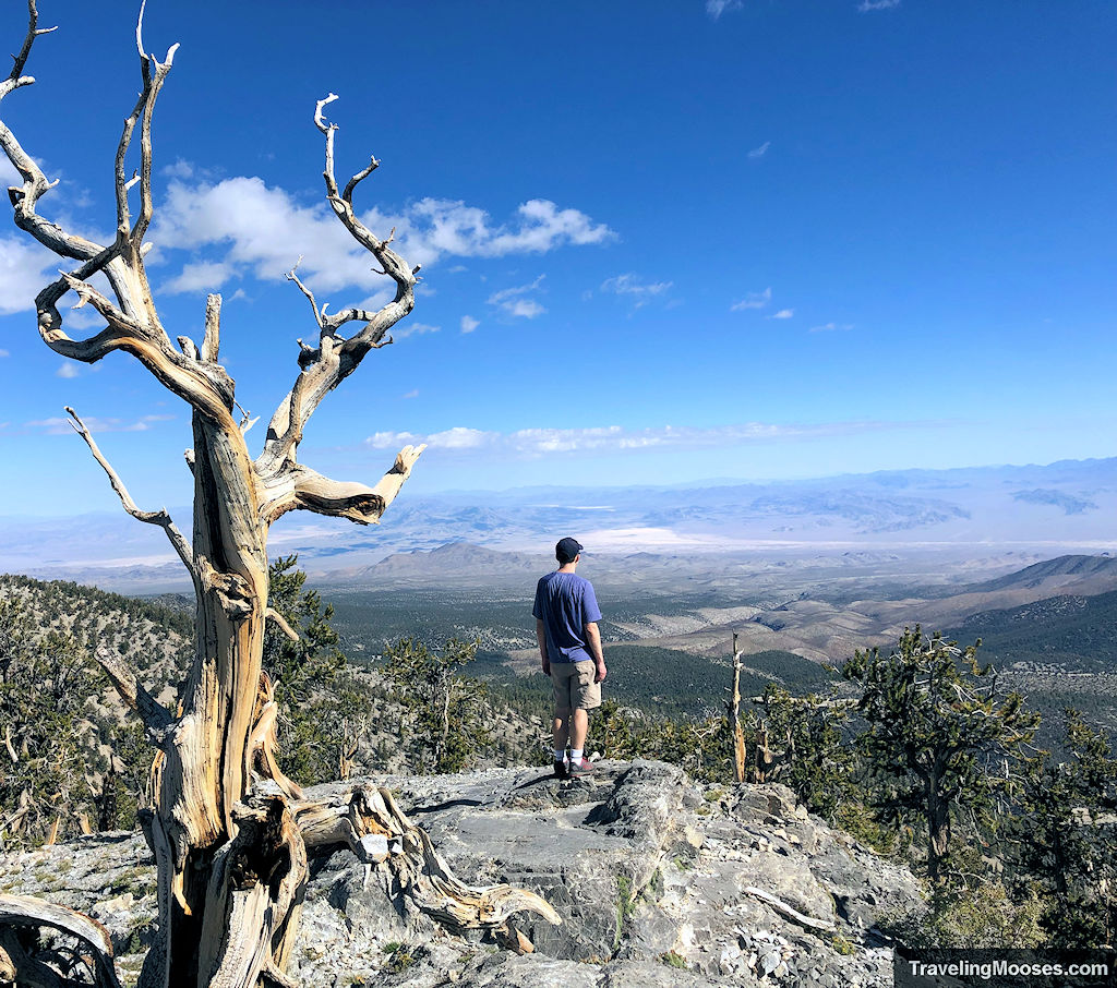
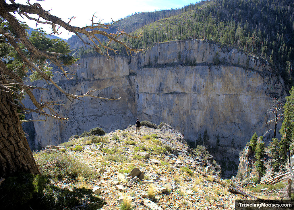
2. Mt. Charleston (Coolest temperatures and forests)
Best for: Summer hiking, all-day adventures, mountain views
Distance from Strip: ~50 minutes
Pass required: No
Why choose Charleston:
Charleston feels like you left Nevada entirely with pine trees, alpine peaks, and 20° cooler temps. It’s where locals escape when the Valley is too hot.
Go here if you want:
✔ A real mountain environment
✔ Shade, cooler temps, longer trails
✔ Escape from desert heat
Skip if:
You want short walks or red rock scenery.
Popular hikes in this region:
– Mary Jane Falls
– Cathedral Rock
– Raintree / Bristlecone
– Fletcher Peak
→ Planning a trip?
Read our Mt. Charleston Hiking Guide (cooler temperatures, best trails, and secrets only locals know).
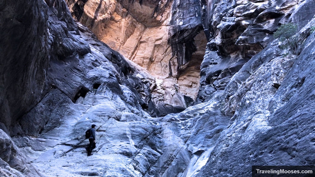
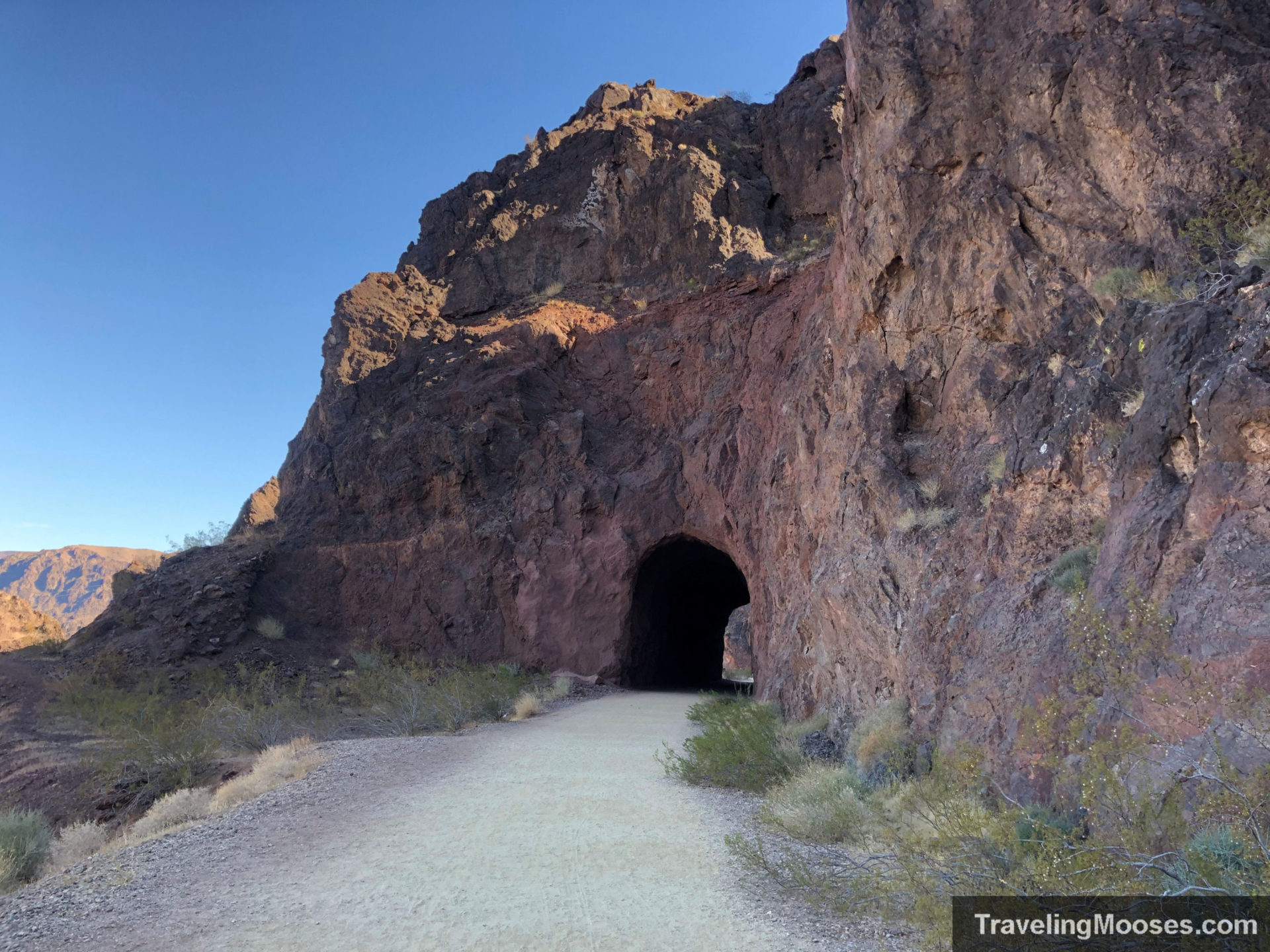
3. Lake Mead National Recreation Area
Best for: Slot canyons, lake overlooks, winter hiking
Distance from Strip: ~40 minutes
Pass required: Yes
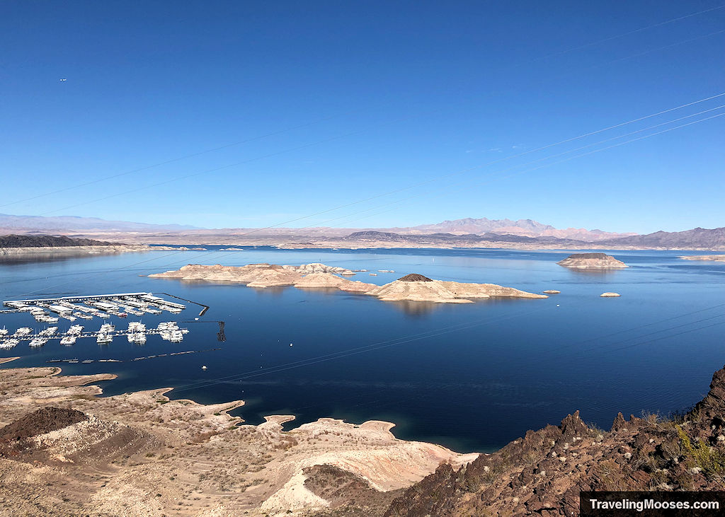
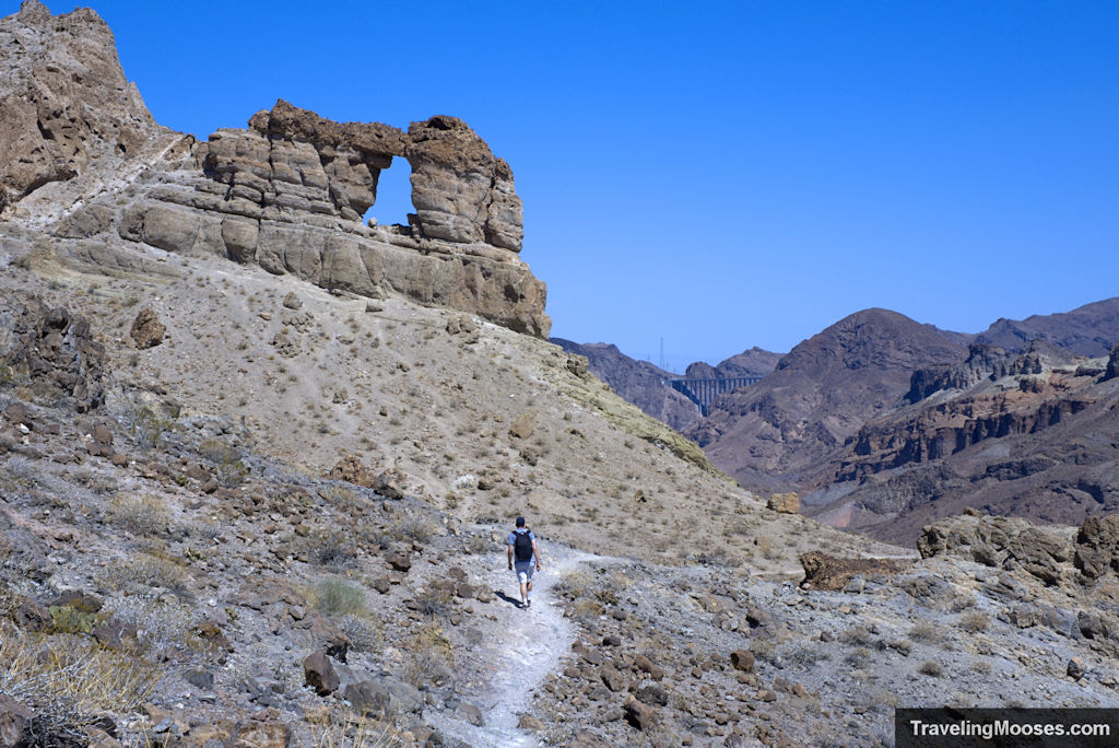
Why choose Lake Mead:
This region delivers big desert landscapes, hidden slot canyons, and sweeping lake views. It’s less crowded than Red Rock and perfect during cooler months.
Go here if you want:
✔ Quieter trails
✔ Slot canyons and desert washes
✔ Lake views and unique rock formations
Skip if:
You’re visiting in summer — many trails close due to heat.
Popular hikes in this region:
– Historic Railroad Trail
– White Owl Canyon
– Anniversary Narrows
– Liberty Bell Arch
4. Valley of Fire (Most Photogenic)
Best for: Short, stunning trails; vibrant rock formations; sunrise/sunset
Distance from Strip: ~50 minutes
Pass required: Yes
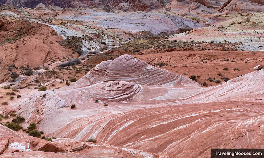
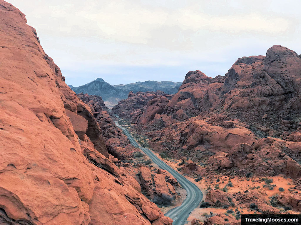
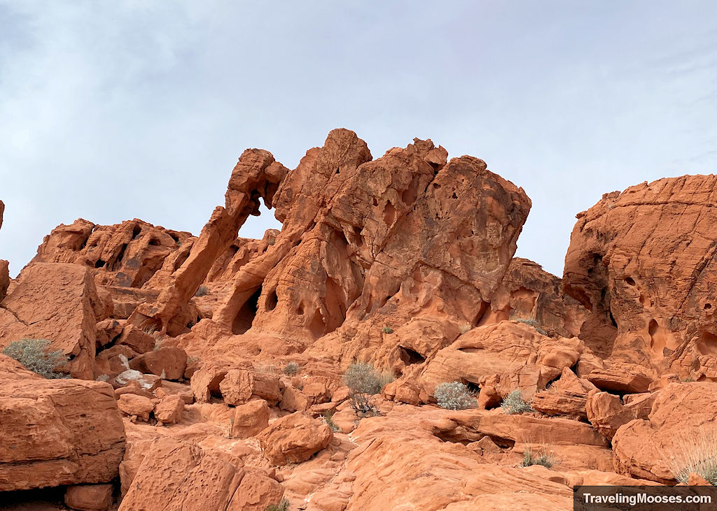
Why choose Valley of Fire:
This area has the most dramatic colors — bright red sandstone, wave patterns, slot canyons, and ancient petroglyphs. It’s a must-see for photographers.
Go here if you want:
✔ Fast, beautiful trails
✔ Photo opportunities
✔ A compact park you can explore in a few hours
Skip if:
You dislike crowds on Instagram-popular spots.
Popular hikes in this region:
– Fire Wave
– White Domes
– Mouse’s Tank Petroglyph Canyon
– Silica Dome
→ Curious if it’s worth the drive?
Check out our Valley of Fire Guide (Fire Wave, White Domes, and the most photogenic spots).
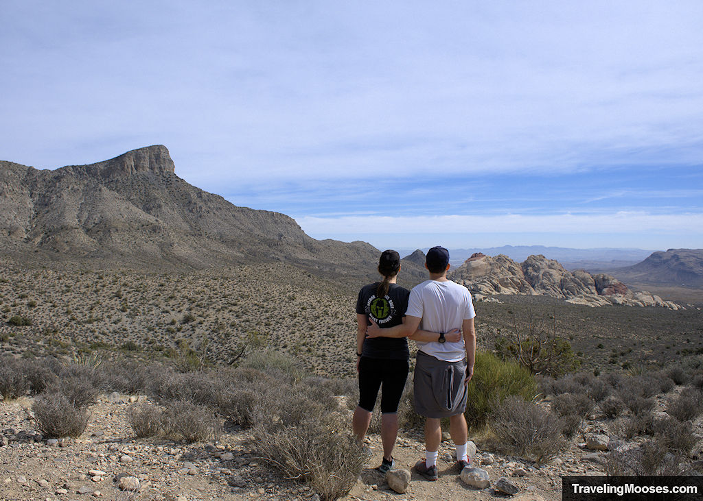
5. Sloan Canyon (Petroglyphs & City Views)
Best for: Quiet trails, Vegas skyline views, ancient rock art
Distance from Strip: ~25 minutes
Pass required: No
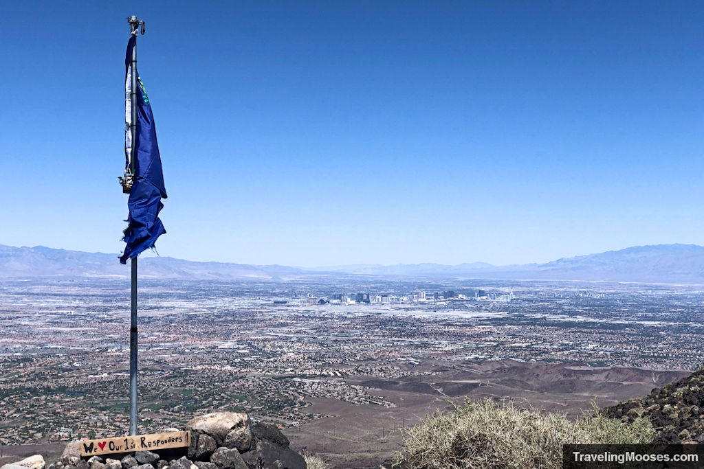
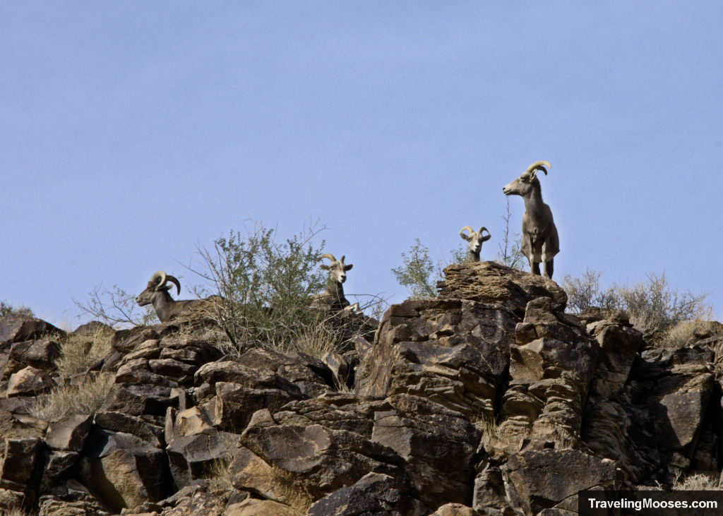
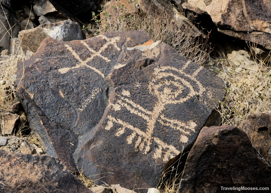
Why choose Sloan Canyon:
Sloan offers rugged desert terrain, volcanic rock, and one of the largest petroglyph sites in the region. It’s the quietest of the five areas and closest to Henderson.
Go here if you want:
✔ Solitude
✔ Petroglyphs
✔ Sweeping views of the Vegas valley
Skip if:
You want marked, developed trails — Sloan is more primitive.
Popular hikes in this region:
– Petroglyph Canyon
– Black Mountain
– Anthem East Trail
Quick Comparison Table
| Region | Drive Time | Scenery | Best For | Crowds |
|---|---|---|---|---|
| Red Rock | 25 min | Red sandstone | First-timers, classic Vegas | High |
| Mt. Charleston | 50 min | Pine forest, peaks | Summer hikes, long trails | Medium |
| Lake Mead | 40 min | Slot canyons, lake | Winter hiking, solitude | Low–Medium |
| Valley of Fire | 50 min | Bright red rock, wave formations | Photography | High |
| Sloan Canyon | 25 min | Desert, petroglyphs | Quiet trails, views | Low |
How to Choose the Right Area (Local shortcuts)
- Only have 1–2 hours? → Go to Red Rock
- Visiting in summer? → Go to Mt. Charleston
- Want the fewest crowds? → Go to Lake Mead or Sloan
- Care most about photography? → Valley of Fire
- Want petroglyphs? → Sloan Canyon or Valley of Fire
- Want easy family-friendly trails? → Red Rock or Valley of Fire
Map: Hiking Areas Around Las Vegas
If you want to explore individual trails within each region, use this map to browse every hike we’ve reviewed. You can also open it directly in google maps here.